Pekanbaru elevation
Pekanbaru (Riau), Indonesia elevation is 19 meters and Pekanbaru elevation in feet is 62 ft above sea level [src 1]. Pekanbaru is a seat of a first-order administrative division (feature code) with elevation that is 172 meters (564 ft) smaller than average city elevation in Indonesia.
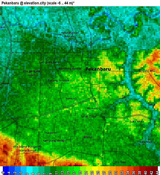
Below is the Elevation map of Pekanbaru, which displays elevation range with different colors. Scale of the first map is from -6 to 44 m (-20 to 144 ft) with average elevation of 13.1 meters (=43 ft) [note 1]
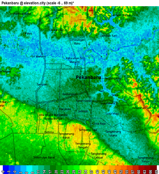
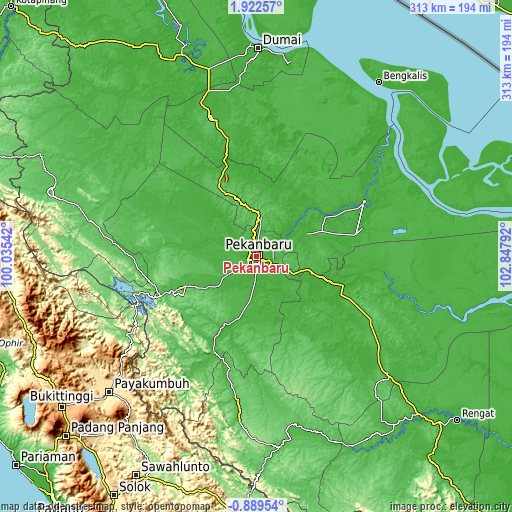
These maps also provides idea of topography and contour of this city, they are displayed at different zoom levels. More info about maps, scale and edge coordinates you can find below images.
| \ | Map #1 | Map #2 | Topo.Map |
| Scale [m] | -6..44 m | -6..69 m | × |
| Scale [ft] | -20..144 ft | -20..226 ft | × |
| Average | 13.1 m = 43 ft | 19 m = 62 ft | × |
| Width | 9.77 km = 6.1 mi | 19.54 km = 12.1 mi | 312.7 km = 194.3 mi |
| Height | 9.77 km = 6.1 mi | 19.54 km = 12.1 mi | 312.7 km = 194.3 mi |
| ↑Max Latitude | 0.560613° | 0.604556° | 1.92257° |
| Latitude at center | 0.51667° | 0.51667° | 0.51667° |
| ↓Min Latitude | 0.472726° | 0.428782° | -0.88954° |
| ← Min Longitude | 101.397725° | 101.353779° | 100.03542° |
| Longitude center | 101.44167° | 101.44167° | 101.44167° |
| →Max Longitude | 101.485615° | 101.529561° | 102.84792° |
Nearby cities:
Cities around Pekanbaru sort by population:
• Balaipungut elevation 16 m
62.7 km,  344°
344°
• Teluk Kuantan 54 m
117.2 km,  172°
172°
• Rokan 97 m
115.1 km,  272°
272°
• Sarilamak 501 m
113.9 km,  229°
229°
• Tanjungpati 501 m
113.3 km, 228°
• Baserah 34 m
112.2 km,  162°
162°
• Muaralembu 63 m
100.4 km,  186°
186°
• Duri 53 m
88.8 km, 341°
• Pangkalanbunut 27 m
82 km,  107°
107°
• Siak Sri Indrapura 5 m
74.4 km,  65°
65°
• Bangkinang 44 m
50.5 km,  246°
246°
• Pangkalan Kerinci 16 m
48.1 km, 106°
Multilingual:
 En español:
Pekanbaru elevación 19 m.
 En France:
Pekanbaru élévation 19 m.
 Auf Deutsch:
Pekanbaru höhe über dem Meeresspiegel ist 19 m.

Sources and notes:
- [note 1] Map square and city borders are not equal. Map elevation data is calculated only from area inside that square.
- [src 1] Elevation data from geonames database provided with same terms of usage.
- [src 2] The elevation map of Pekanbaru is generated using elevation data from NASA's 3 arcsec (90m) resolution SRTM data.
- [src 3] Base (background) map © OpenStreetMap contributors tiles are generated by Geofabrik and OpenTopoMap.
Copyright & License:
This Pekanbaru Elevation Map is licensed under CC BY-SA. You may reuse any part from this page, if you give a proper credit by linking to this URL:
 More info on terms of use page.