Balaipungut elevation
Balaipungut (Riau), Indonesia elevation is 16 meters and Balaipungut elevation in feet is 52 ft above sea level [src 1]. Balaipungut is a populated place (feature code) with elevation that is 175 meters (574 ft) smaller than average city elevation in Indonesia.
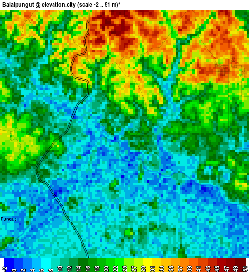
Below is the Elevation map of Balaipungut, which displays elevation range with different colors. Scale of the first map is from -2 to 51 m (-7 to 167 ft) with average elevation of 16.5 meters (=54 ft) [note 1]
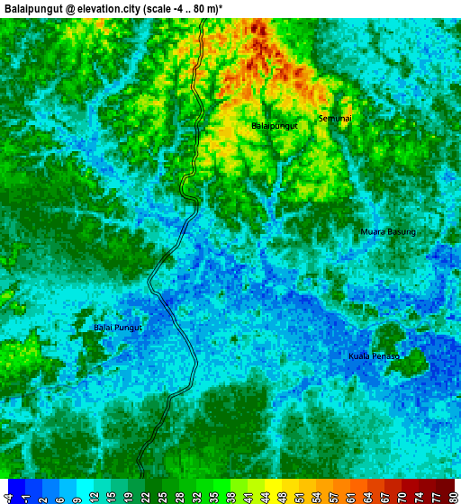
These maps also provides idea of topography and contour of this city, they are displayed at different zoom levels. More info about maps, scale and edge coordinates you can find below images.
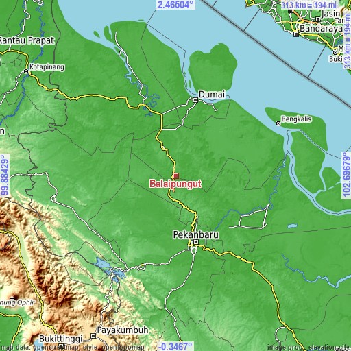
| \ | Map #1 | Map #2 | Topo.Map |
| Scale [m] | -2..51 m | -4..80 m | × |
| Scale [ft] | -7..167 ft | -13..262 ft | × |
| Average | 16.5 m = 54 ft | 19.6 m = 64 ft | × |
| Width | 9.77 km = 6.1 mi | 19.54 km = 12.1 mi | 312.6 km = 194.2 mi |
| Height | 9.77 km = 6.1 mi | 19.54 km = 12.1 mi | 312.7 km = 194.3 mi |
| ↑Max Latitude | 1.103427° | 1.147364° | 2.46504° |
| Latitude at center | 1.05949° | 1.05949° | 1.05949° |
| ↓Min Latitude | 1.015552° | 0.971613° | -0.3467° |
| ← Min Longitude | 101.246595° | 101.202649° | 99.88429° |
| Longitude center | 101.29054° | 101.29054° | 101.29054° |
| →Max Longitude | 101.334485° | 101.378431° | 102.69679° |
Nearby cities:
Cities around Balaipungut sort by population:
• Pekanbaru elevation 19 m
62.7 km,  164°
164°
• Dumai 7 m
69.7 km,  14°
14°
• Pasir Pengaraian 58 m
112.7 km,  258°
258°
• Rokan 97 m
112.3 km,  240°
240°
• Bengkalis 7 m
104.1 km,  64°
64°
• Pangkalan Kerinci 16 m
97 km,  139°
139°
• Siak Sri Indrapura 5 m
89.6 km,  109°
109°
• Bangkinang 44 m
85.5 km,  200°
200°
• Kotatengah 28 m
81.9 km,  272°
272°
• Batu Panjang 6 m
76.7 km,  18°
18°
• Sedinginan 24 m
62.9 km,  330°
330°
• Duri 53 m
26.3 km,  336°
336°
Multilingual:
 En español:
Balaipungut elevación 16 m.
 En France:
Balaipungut élévation 16 m.
 Auf Deutsch:
Balaipungut höhe über dem Meeresspiegel ist 16 m.

Sources and notes:
- [note 1] Map square and city borders are not equal. Map elevation data is calculated only from area inside that square.
- [src 1] Elevation data from geonames database provided with same terms of usage.
- [src 2] The elevation map of Balaipungut is generated using elevation data from NASA's 3 arcsec (90m) resolution SRTM data.
- [src 3] Base (background) map © OpenStreetMap contributors tiles are generated by Geofabrik and OpenTopoMap.
Copyright & License:
This Balaipungut Elevation Map is licensed under CC BY-SA. You may reuse any part from this page, if you give a proper credit by linking to this URL:
 More info on terms of use page.