Rakamaz elevation
Rakamaz (Szabolcs-Szatmár-Bereg), Hungary elevation is 102 meters and Rakamaz elevation in feet is 335 ft above sea level [src 1]. Rakamaz is a populated place (feature code) with elevation that is 27 meters (89 ft) smaller than average city elevation in Hungary.
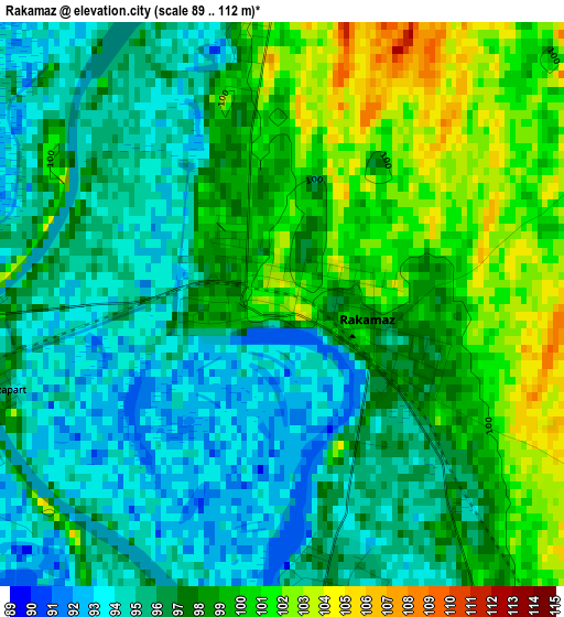
Below is the Elevation map of Rakamaz, which displays elevation range with different colors. Scale of the first map is from 89 to 112 m (292 to 367 ft) with average elevation of 97.1 meters (=319 ft) [note 1]
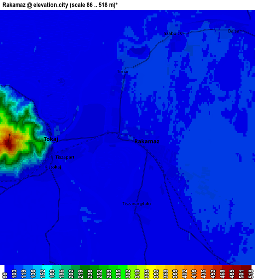
These maps also provides idea of topography and contour of this city, they are displayed at different zoom levels. More info about maps, scale and edge coordinates you can find below images.
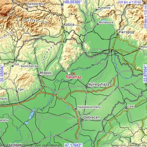
| \ | Map #1 | Map #2 | Topo.Map |
| Scale [m] | 89..112 m | 86..518 m | × |
| Scale [ft] | 292..367 ft | 282..1699 ft | × |
| Average | 97.1 m = 319 ft | 104.8 m = 344 ft | × |
| Width | 6.52 km = 4.1 mi | 13.05 km = 8.1 mi | 208.8 km = 129.7 mi |
| Height | 6.52 km = 4.1 mi | 13.05 km = 8.1 mi | 208.7 km = 129.7 mi |
| ↑Max Latitude | 48.153046° | 48.182356° | 49.05386° |
| Latitude at center | 48.12372° | 48.12372° | 48.12372° |
| ↓Min Latitude | 48.094377° | 48.065017° | 47.17643° |
| ← Min Longitude | 21.420345° | 21.376399° | 20.05804° |
| Longitude center | 21.46429° | 21.46429° | 21.46429° |
| →Max Longitude | 21.508235° | 21.552181° | 22.87054° |
Nearby cities:
Cities around Rakamaz sort by population:
• Nyírtelek elevation 101 m
17.3 km,  133°
133°
• Tiszalök 93 m
13.3 km,  206°
206°
• Tokaj 95 m
3.6 km,  257°
257°
• Tarcal 147 m
8.5 km,  277°
277°
• Tiszaeszlár 95 m
8.2 km,  178°
178°
• Mád 158 m
15.6 km,  300°
300°
• Prügy 95 m
16.5 km,  254°
254°
• Mezőzombor 94 m
15 km, 281°
• Buj 98 m
14 km,  100°
100°
• Tiszabercel 100 m
14.1 km,  78°
78°
• Tiszanagyfalu 96 m
3 km,  151°
151°
• Olaszliszka 114 m
14.2 km,  350°
350°
Multilingual:
 En español:
Rakamaz elevación 102 m.
 En France:
Rakamaz élévation 102 m.


Sources and notes:
- [note 1] Map square and city borders are not equal. Map elevation data is calculated only from area inside that square.
- [src 1] Elevation data from geonames database provided with same terms of usage.
- [src 2] The elevation map of Rakamaz is generated using elevation data from NASA's 3 arcsec (90m) resolution SRTM data.
- [src 3] Base (background) map © OpenStreetMap contributors tiles are generated by Geofabrik and OpenTopoMap.
Copyright & License:
This Rakamaz Elevation Map is licensed under CC BY-SA. You may reuse any part from this page, if you give a proper credit by linking to this URL:
 More info on terms of use page.