Nyírtelek elevation
Nyírtelek (Szabolcs-Szatmár-Bereg), Hungary elevation is 101 meters and Nyírtelek elevation in feet is 331 ft above sea level [src 1]. Nyírtelek is a populated place (feature code) with elevation that is 28 meters (92 ft) smaller than average city elevation in Hungary.
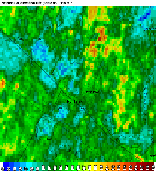
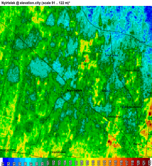
Below is the Elevation map of Nyírtelek, which displays elevation range with different colors. Scale of the first map is from 93 to 115 m (305 to 377 ft) with average elevation of 101.9 meters (=334 ft) [note 1]
These maps also provides idea of topography and contour of this city, they are displayed at different zoom levels. More info about maps, scale and edge coordinates you can find below images.
| \ | Map #1 | Map #2 | Topo.Map |
| Scale [m] | 93..115 m | 91..122 m | × |
| Scale [ft] | 305..377 ft | 299..400 ft | × |
| Average | 101.9 m = 334 ft | 102.4 m = 336 ft | × |
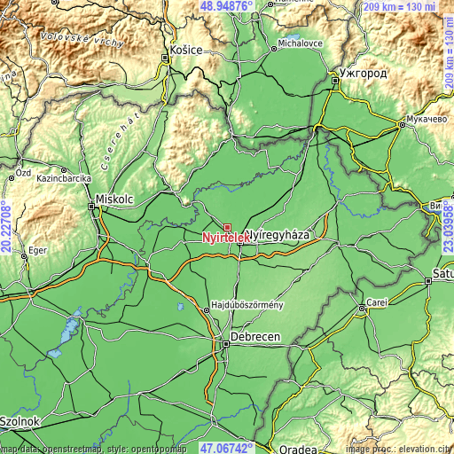
| Width | 6.54 km = 4.1 mi | 13.07 km = 8.1 mi | 209.2 km = 130 mi |
| Height | 6.54 km = 4.1 mi | 13.07 km = 8.1 mi | 209.2 km = 130 mi |
| ↑Max Latitude | 48.046057° | 48.075428° | 48.94876° |
| Latitude at center | 48.01667° | 48.01667° | 48.01667° |
| ↓Min Latitude | 47.987266° | 47.957845° | 47.06742° |
| ← Min Longitude | 21.589385° | 21.545439° | 20.22708° |
| Longitude center | 21.63333° | 21.63333° | 21.63333° |
| →Max Longitude | 21.677275° | 21.721221° | 23.03958° |
Nearby cities:
Cities around Nyírtelek sort by population:
• Nyíregyháza elevation 111 m
9.2 km,  137°
137°
• Ibrány 100 m
13.1 km,  25°
25°
• Nagyhalász 97 m
16 km,  36°
36°
• Kemecse 97 m
14.4 km,  63°
63°
• Kótaj 94 m
7.2 km, 59°
• Nyírpazony 107 m
12.9 km,  106°
106°
• Tiszaeszlár 95 m
12.9 km,  286°
286°
• Buj 98 m
9.3 km,  7°
7°
• Kálmánháza 115 m
15.3 km,  194°
194°
• Tiszabercel 100 m
14.9 km,  4°
4°
• Tiszanagyfalu 96 m
14.5 km,  309°
309°
• Nagycserkesz 104 m
9.3 km,  233°
233°
Multilingual:
 En español:
Nyírtelek elevación 101 m.
 En France:
Nyírtelek élévation 101 m.
 Auf Deutsch:
Nyírtelek höhe über dem Meeresspiegel ist 101 m.

Sources and notes:
- [note 1] Map square and city borders are not equal. Map elevation data is calculated only from area inside that square.
- [src 1] Elevation data from geonames database provided with same terms of usage.
- [src 2] The elevation map of Nyírtelek is generated using elevation data from NASA's 3 arcsec (90m) resolution SRTM data.
- [src 3] Base (background) map © OpenStreetMap contributors tiles are generated by Geofabrik and OpenTopoMap.
Copyright & License:
This Nyírtelek Elevation Map is licensed under CC BY-SA. You may reuse any part from this page, if you give a proper credit by linking to this URL:
 More info on terms of use page.