Bag elevation
Bag (Pest), Hungary elevation is 136 meters and Bag elevation in feet is 446 ft above sea level [src 1]. Bag is a populated place (feature code) with elevation that is 7 meters (23 ft) bigger than average city elevation in Hungary.
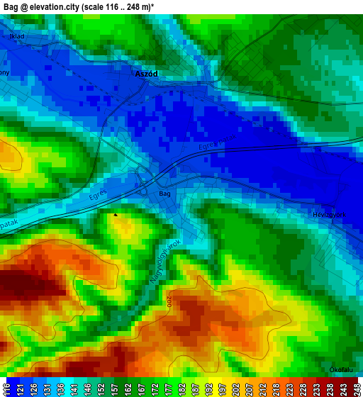
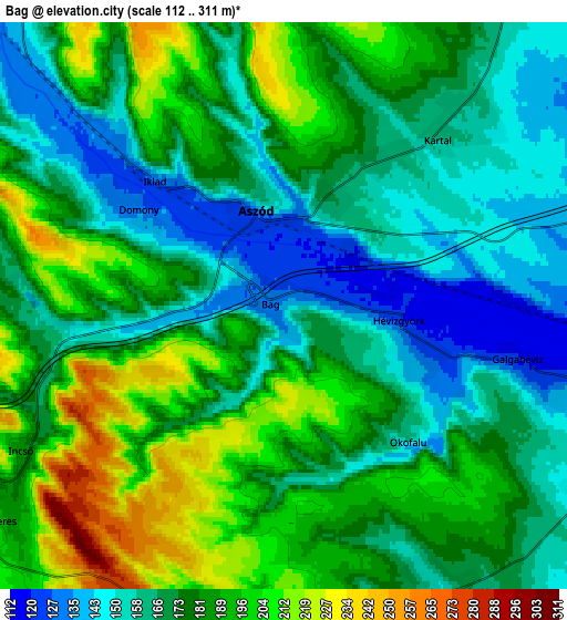
Below is the Elevation map of Bag, which displays elevation range with different colors. Scale of the first map is from 116 to 248 m (381 to 814 ft) with average elevation of 161.4 meters (=530 ft) [note 1]
These maps also provides idea of topography and contour of this city, they are displayed at different zoom levels. More info about maps, scale and edge coordinates you can find below images.
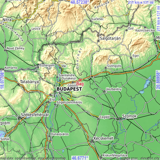
| \ | Map #1 | Map #2 | Topo.Map |
| Scale [m] | 116..248 m | 112..311 m | × |
| Scale [ft] | 381..814 ft | 367..1020 ft | × |
| Average | 161.4 m = 530 ft | 176.4 m = 579 ft | × |
| Width | 6.59 km = 4.1 mi | 13.17 km = 8.2 mi | 210.7 km = 130.9 mi |
| Height | 6.59 km = 4.1 mi | 13.17 km = 8.2 mi | 210.7 km = 130.9 mi |
| ↑Max Latitude | 47.662935° | 47.692524° | 48.57238° |
| Latitude at center | 47.63333° | 47.63333° | 47.63333° |
| ↓Min Latitude | 47.603708° | 47.574069° | 46.6771° |
| ← Min Longitude | 19.439385° | 19.395439° | 18.07708° |
| Longitude center | 19.48333° | 19.48333° | 19.48333° |
| →Max Longitude | 19.527275° | 19.571221° | 20.88958° |
Nearby cities:
Cities around Bag sort by population:
• Gödöllő elevation 210 m
10.4 km,  246°
246°
• Tura 115 m
9.3 km,  106°
106°
• Aszód 128 m
2.1 km,  349°
349°
• Kartal 155 m
6.1 km,  46°
46°
• Szada 247 m
12.5 km,  270°
270°
• Hévízgyörk 117 m
2.5 km,  90°
90°
• Galgahévíz 126 m
6.5 km, 106°
• Valkó 155 m
8 km,  164°
164°
• Iklad 140 m
5 km,  315°
315°
• Vácszentlászló 165 m
7.8 km,  148°
148°
• Galgamácsa 146 m
10 km,  313°
313°
• Domony 131 m
4.6 km,  302°
302°
Multilingual:
 En español:
Bag elevación 136 m.
 En France:
Bag élévation 136 m.


Sources and notes:
- [note 1] Map square and city borders are not equal. Map elevation data is calculated only from area inside that square.
- [src 1] Elevation data from geonames database provided with same terms of usage.
- [src 2] The elevation map of Bag is generated using elevation data from NASA's 3 arcsec (90m) resolution SRTM data.
- [src 3] Base (background) map © OpenStreetMap contributors tiles are generated by Geofabrik and OpenTopoMap.
Copyright & License:
This Bag Elevation Map is licensed under CC BY-SA. You may reuse any part from this page, if you give a proper credit by linking to this URL:
 More info on terms of use page.