Tura elevation
Tura (Pest), Hungary elevation is 115 meters and Tura elevation in feet is 377 ft above sea level [src 1]. Tura is a populated place (feature code) with elevation that is 14 meters (46 ft) smaller than average city elevation in Hungary.
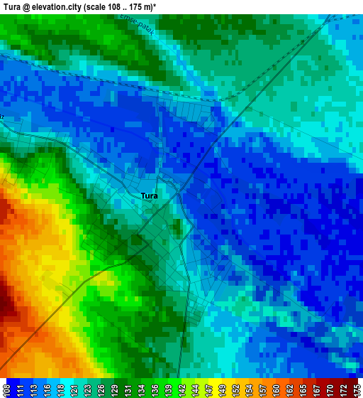
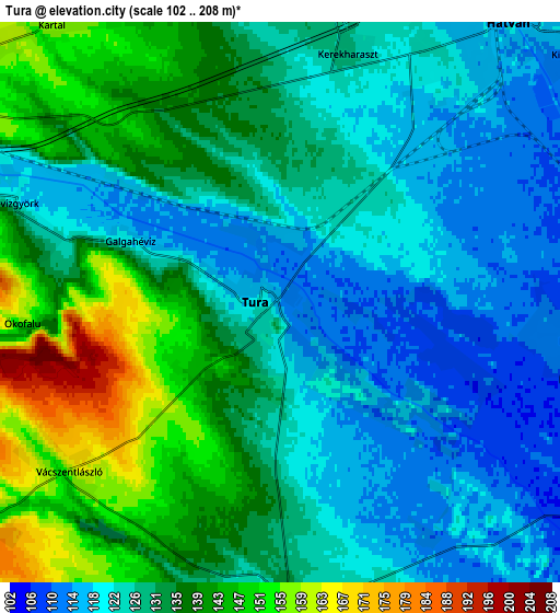
Below is the Elevation map of Tura, which displays elevation range with different colors. Scale of the first map is from 108 to 175 m (354 to 574 ft) with average elevation of 124.4 meters (=408 ft) [note 1]
These maps also provides idea of topography and contour of this city, they are displayed at different zoom levels. More info about maps, scale and edge coordinates you can find below images.
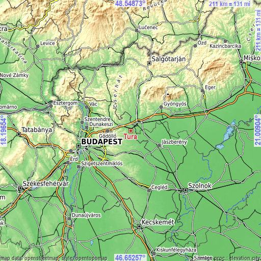
| \ | Map #1 | Map #2 | Topo.Map |
| Scale [m] | 108..175 m | 102..208 m | × |
| Scale [ft] | 354..574 ft | 335..682 ft | × |
| Average | 124.4 m = 408 ft | 130.3 m = 427 ft | × |
| Width | 6.59 km = 4.1 mi | 13.18 km = 8.2 mi | 210.8 km = 131 mi |
| Height | 6.59 km = 4.1 mi | 13.18 km = 8.2 mi | 210.8 km = 131 mi |
| ↑Max Latitude | 47.638859° | 47.668461° | 48.54873° |
| Latitude at center | 47.60924° | 47.60924° | 47.60924° |
| ↓Min Latitude | 47.579604° | 47.549952° | 46.65257° |
| ← Min Longitude | 19.558845° | 19.514899° | 18.19654° |
| Longitude center | 19.60279° | 19.60279° | 19.60279° |
| →Max Longitude | 19.646735° | 19.690681° | 21.00904° |
Nearby cities:
Cities around Tura sort by population:
• Hatvan elevation 117 m
8.8 km,  43°
43°
• Aszód 128 m
10.4 km,  296°
296°
• Kartal 155 m
8.3 km,  326°
326°
• Dány 163 m
10.9 km,  203°
203°
• Bag 136 m
9.3 km,  286°
286°
• Boldog 112 m
6.5 km,  96°
96°
• Hévízgyörk 117 m
7 km, 292°
• Galgahévíz 126 m
2.8 km, 286°
• Zsámbok 130 m
7.3 km,  175°
175°
• Valkó 155 m
8.4 km,  233°
233°
• Vácszentlászló 165 m
6.3 km, 231°
• Heréd 122 m
11 km,  11°
11°
Multilingual:
 En español:
Tura elevación 115 m.
 En France:
Tura élévation 115 m.


Sources and notes:
- [note 1] Map square and city borders are not equal. Map elevation data is calculated only from area inside that square.
- [src 1] Elevation data from geonames database provided with same terms of usage.
- [src 2] The elevation map of Tura is generated using elevation data from NASA's 3 arcsec (90m) resolution SRTM data.
- [src 3] Base (background) map © OpenStreetMap contributors tiles are generated by Geofabrik and OpenTopoMap.
Copyright & License:
This Tura Elevation Map is licensed under CC BY-SA. You may reuse any part from this page, if you give a proper credit by linking to this URL:
 More info on terms of use page.