Balatonlelle elevation
Balatonlelle (Somogy), Hungary elevation is 112 meters and Balatonlelle elevation in feet is 367 ft above sea level [src 1]. Balatonlelle is a populated place (feature code) with elevation that is 17 meters (56 ft) smaller than average city elevation in Hungary.
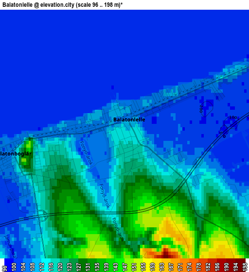
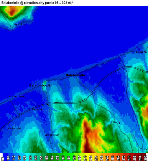
Below is the Elevation map of Balatonlelle, which displays elevation range with different colors. Scale of the first map is from 96 to 198 m (315 to 650 ft) with average elevation of 111.8 meters (=367 ft) [note 1]
These maps also provides idea of topography and contour of this city, they are displayed at different zoom levels. More info about maps, scale and edge coordinates you can find below images.
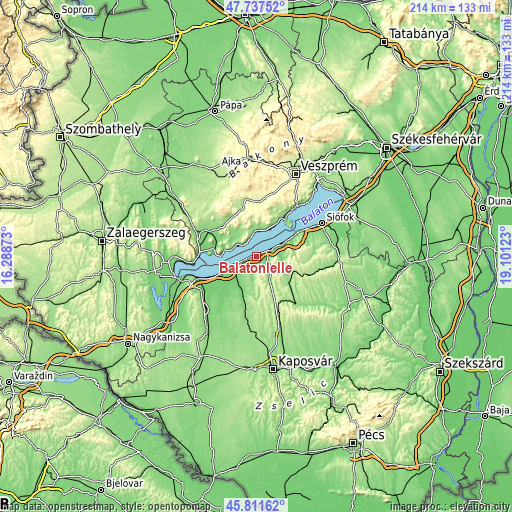
| \ | Map #1 | Map #2 | Topo.Map |
| Scale [m] | 96..198 m | 96..302 m | × |
| Scale [ft] | 315..650 ft | 315..991 ft | × |
| Average | 111.8 m = 367 ft | 120.8 m = 396 ft | × |
| Width | 6.69 km = 4.2 mi | 13.38 km = 8.3 mi | 214.1 km = 133 mi |
| Height | 6.69 km = 4.2 mi | 13.38 km = 8.3 mi | 214.1 km = 133 mi |
| ↑Max Latitude | 46.813264° | 46.84333° | 47.73752° |
| Latitude at center | 46.78318° | 46.78318° | 46.78318° |
| ↓Min Latitude | 46.75308° | 46.722962° | 45.81162° |
| ← Min Longitude | 17.651035° | 17.607089° | 16.28873° |
| Longitude center | 17.69498° | 17.69498° | 17.69498° |
| →Max Longitude | 17.738925° | 17.782871° | 19.10123° |
Nearby cities:
Cities around Balatonlelle sort by population:
• Tapolca elevation 124 m
22.2 km,  299°
299°
• Balatonboglár 104 m
4 km,  257°
257°
• Fonyód 106 m
9.3 km,  250°
250°
• Lengyeltóti 147 m
13.2 km,  197°
197°
• Badacsonytomaj 112 m
14 km,  280°
280°
• Balatonföldvár 109 m
16.1 km,  61°
61°
• Balatonszárszó 114 m
11.1 km, 62°
• Balatonfenyves 109 m
17.2 km,  243°
243°
• Karád 190 m
15.2 km,  132°
132°
• Tihany 175 m
20.7 km,  45°
45°
• Révfülöp 125 m
7.4 km,  309°
309°
• Zánka 110 m
9.8 km,  355°
355°
Multilingual:
 En español:
Balatonlelle elevación 112 m.
 En France:
Balatonlelle élévation 112 m.
 Auf Deutsch:
Balatonlelle höhe über dem Meeresspiegel ist 112 m.

Sources and notes:
- [note 1] Map square and city borders are not equal. Map elevation data is calculated only from area inside that square.
- [src 1] Elevation data from geonames database provided with same terms of usage.
- [src 2] The elevation map of Balatonlelle is generated using elevation data from NASA's 3 arcsec (90m) resolution SRTM data.
- [src 3] Base (background) map © OpenStreetMap contributors tiles are generated by Geofabrik and OpenTopoMap.
Copyright & License:
This Balatonlelle Elevation Map is licensed under CC BY-SA. You may reuse any part from this page, if you give a proper credit by linking to this URL:
 More info on terms of use page.