Fonyód elevation
Fonyód (Somogy), Hungary elevation is 106 meters and Fonyód elevation in feet is 348 ft above sea level [src 1]. Fonyód is a seat of a second-order administrative division (feature code) with elevation that is 23 meters (75 ft) smaller than average city elevation in Hungary.
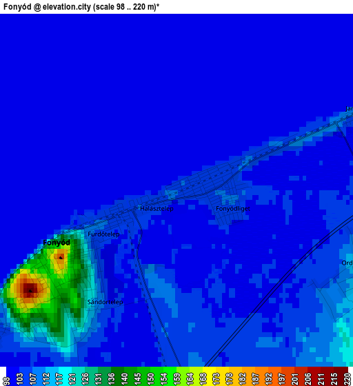
Below is the Elevation map of Fonyód, which displays elevation range with different colors. Scale of the first map is from 98 to 220 m (322 to 722 ft) with average elevation of 104.8 meters (=344 ft) [note 1]
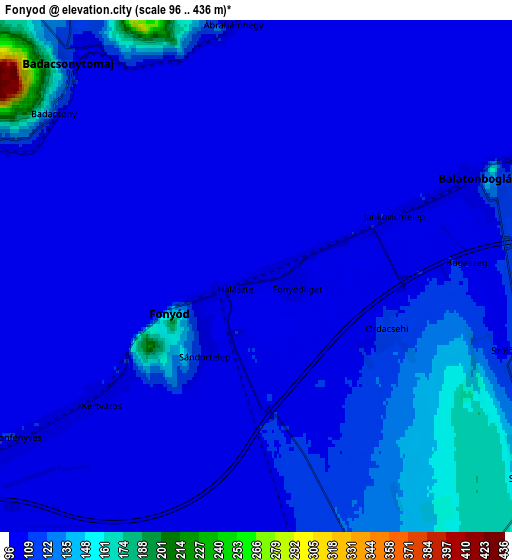
These maps also provides idea of topography and contour of this city, they are displayed at different zoom levels. More info about maps, scale and edge coordinates you can find below images.
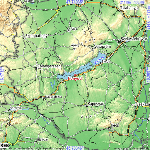
| \ | Map #1 | Map #2 | Topo.Map |
| Scale [m] | 98..220 m | 96..436 m | × |
| Scale [ft] | 322..722 ft | 315..1430 ft | × |
| Average | 104.8 m = 344 ft | 111.5 m = 366 ft | × |
| Width | 6.7 km = 4.2 mi | 13.39 km = 8.3 mi | 214.3 km = 133.2 mi |
| Height | 6.7 km = 4.2 mi | 13.39 km = 8.3 mi | 214.2 km = 133.1 mi |
| ↑Max Latitude | 46.785619° | 46.815701° | 47.71035° |
| Latitude at center | 46.75552° | 46.75552° | 46.75552° |
| ↓Min Latitude | 46.725404° | 46.695271° | 45.78346° |
| ← Min Longitude | 17.535505° | 17.491559° | 16.1732° |
| Longitude center | 17.57945° | 17.57945° | 17.57945° |
| →Max Longitude | 17.623395° | 17.667341° | 18.9857° |
Nearby cities:
Cities around Fonyód sort by population:
• Tapolca elevation 124 m
17.5 km,  323°
323°
• Balatonboglár 104 m
5.4 km,  66°
66°
• Balatonlelle 112 m
9.3 km, 70°
• Lengyeltóti 147 m
10.7 km,  152°
152°
• Kéthely 121 m
18.7 km,  229°
229°
• Badacsonytomaj 112 m
7.6 km, 318°
• Somogyvár 150 m
20.4 km,  161°
161°
• Balatonszárszó 114 m
20.4 km, 66°
• Vonyarcvashegy 113 m
20.4 km,  270°
270°
• Balatonfenyves 109 m
8 km,  236°
236°
• Révfülöp 125 m
8.4 km,  21°
21°
• Zánka 110 m
15.2 km,  31°
31°
Multilingual:
 En español:
Fonyód elevación 106 m.
 En France:
Fonyód élévation 106 m.


Sources and notes:
- [note 1] Map square and city borders are not equal. Map elevation data is calculated only from area inside that square.
- [src 1] Elevation data from geonames database provided with same terms of usage.
- [src 2] The elevation map of Fonyód is generated using elevation data from NASA's 3 arcsec (90m) resolution SRTM data.
- [src 3] Base (background) map © OpenStreetMap contributors tiles are generated by Geofabrik and OpenTopoMap.
Copyright & License:
This Fonyód Elevation Map is licensed under CC BY-SA. You may reuse any part from this page, if you give a proper credit by linking to this URL:
 More info on terms of use page.