Tapolca elevation
Tapolca (Veszprém), Hungary elevation is 124 meters and Tapolca elevation in feet is 407 ft above sea level [src 1]. Tapolca is a seat of a second-order administrative division (feature code) with elevation that is 5 meters (16 ft) smaller than average city elevation in Hungary.
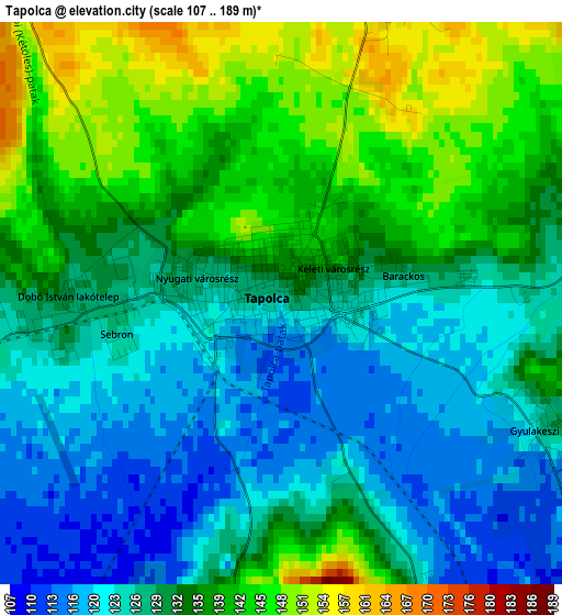
Below is the Elevation map of Tapolca, which displays elevation range with different colors. Scale of the first map is from 107 to 189 m (351 to 620 ft) with average elevation of 131.8 meters (=432 ft) [note 1]
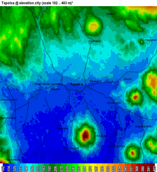
These maps also provides idea of topography and contour of this city, they are displayed at different zoom levels. More info about maps, scale and edge coordinates you can find below images.
| \ | Map #1 | Map #2 | Topo.Map |
| Scale [m] | 107..189 m | 102..403 m | × |
| Scale [ft] | 351..620 ft | 335..1322 ft | × |
| Average | 131.8 m = 432 ft | 158.6 m = 520 ft | × |
| Width | 6.68 km = 4.2 mi | 13.36 km = 8.3 mi | 213.7 km = 132.8 mi |
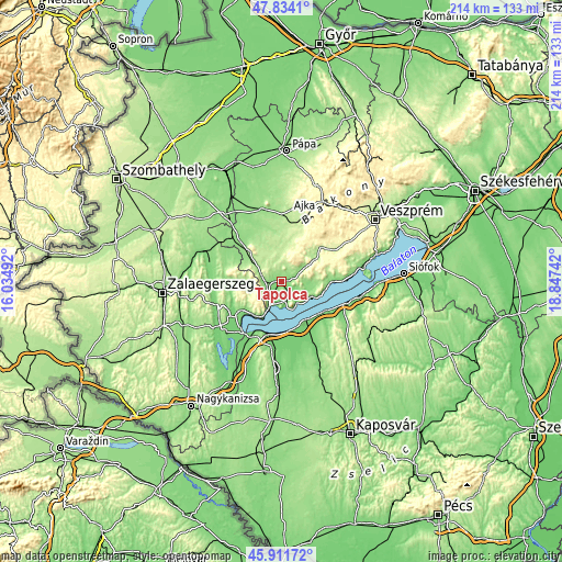
| Height | 6.68 km = 4.2 mi | 13.36 km = 8.3 mi | 213.7 km = 132.8 mi |
| ↑Max Latitude | 46.911549° | 46.94156° | 47.8341° |
| Latitude at center | 46.88152° | 46.88152° | 46.88152° |
| ↓Min Latitude | 46.851475° | 46.821412° | 45.91172° |
| ← Min Longitude | 17.397225° | 17.353279° | 16.03492° |
| Longitude center | 17.44117° | 17.44117° | 17.44117° |
| →Max Longitude | 17.485115° | 17.529061° | 18.84742° |
Nearby cities:
Cities around Tapolca sort by population:
• Keszthely elevation 128 m
19.6 km,  230°
230°
• Sümeg 185 m
16.1 km,  311°
311°
• Balatonboglár 104 m
19.4 km,  127°
127°
• Fonyód 106 m
17.5 km,  143°
143°
• Csabrendek 196 m
18.6 km,  322°
322°
• Gyenesdiás 123 m
17 km,  223°
223°
• Badacsonytomaj 112 m
10 km,  146°
146°
• Cserszegtomaj 183 m
19 km,  242°
242°
• Vonyarcvashegy 113 m
17 km, 215°
• Balatonfenyves 109 m
18.9 km,  168°
168°
• Révfülöp 125 m
14.9 km,  114°
114°
• Zánka 110 m
18.5 km,  93°
93°
Multilingual:
 En español:
Tapolca elevación 124 m.
 En France:
Tapolca élévation 124 m.


Sources and notes:
- [note 1] Map square and city borders are not equal. Map elevation data is calculated only from area inside that square.
- [src 1] Elevation data from geonames database provided with same terms of usage.
- [src 2] The elevation map of Tapolca is generated using elevation data from NASA's 3 arcsec (90m) resolution SRTM data.
- [src 3] Base (background) map © OpenStreetMap contributors tiles are generated by Geofabrik and OpenTopoMap.
Copyright & License:
This Tapolca Elevation Map is licensed under CC BY-SA. You may reuse any part from this page, if you give a proper credit by linking to this URL:
 More info on terms of use page.