Sümeg elevation
Sümeg (Veszprém), Hungary elevation is 185 meters and Sümeg elevation in feet is 607 ft above sea level [src 1]. Sümeg is a populated place (feature code) with elevation that is 56 meters (184 ft) bigger than average city elevation in Hungary.
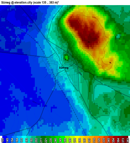
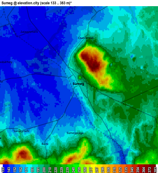
Below is the Elevation map of Sümeg, which displays elevation range with different colors. Scale of the first map is from 135 to 383 m (443 to 1257 ft) with average elevation of 191.5 meters (=628 ft) [note 1]
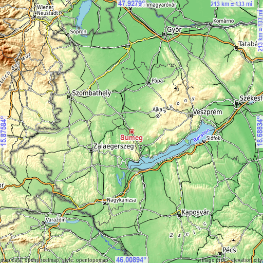
These maps also provides idea of topography and contour of this city, they are displayed at different zoom levels. More info about maps, scale and edge coordinates you can find below images.
| \ | Map #1 | Map #2 | Topo.Map |
| Scale [m] | 135..383 m | 133..383 m | × |
| Scale [ft] | 443..1257 ft | 436..1257 ft | × |
| Average | 191.5 m = 628 ft | 183.5 m = 602 ft | × |
| Width | 6.67 km = 4.1 mi | 13.34 km = 8.3 mi | 213.4 km = 132.6 mi |
| Height | 6.67 km = 4.1 mi | 13.34 km = 8.3 mi | 213.4 km = 132.6 mi |
| ↑Max Latitude | 47.007005° | 47.036963° | 47.9279° |
| Latitude at center | 46.97703° | 46.97703° | 46.97703° |
| ↓Min Latitude | 46.947038° | 46.917029° | 46.00894° |
| ← Min Longitude | 17.238145° | 17.194199° | 15.87584° |
| Longitude center | 17.28209° | 17.28209° | 17.28209° |
| →Max Longitude | 17.326035° | 17.369981° | 18.68834° |
Nearby cities:
Cities around Sümeg sort by population:
• Ajka elevation 225 m
25.2 km,  56°
56°
• Keszthely 128 m
23.4 km,  187°
187°
• Tapolca 124 m
16.1 km,  131°
131°
• Zalaszentgrót 124 m
15.8 km,  256°
256°
• Devecser 175 m
18.3 km,  40°
40°
• Hévíz 140 m
22.1 km,  199°
199°
• Csabrendek 196 m
4.1 km,  9°
9°
• Gyenesdiás 123 m
23 km,  179°
179°
• Jánosháza 148 m
18.1 km,  330°
330°
• Cserszegtomaj 183 m
20 km, 193°
• Vonyarcvashegy 113 m
24.5 km,  174°
174°
• Türje 141 m
13.3 km,  273°
273°
Multilingual:
 En español:
Sümeg elevación 185 m.
 En France:
Sümeg élévation 185 m.


Sources and notes:
- [note 1] Map square and city borders are not equal. Map elevation data is calculated only from area inside that square.
- [src 1] Elevation data from geonames database provided with same terms of usage.
- [src 2] The elevation map of Sümeg is generated using elevation data from NASA's 3 arcsec (90m) resolution SRTM data.
- [src 3] Base (background) map © OpenStreetMap contributors tiles are generated by Geofabrik and OpenTopoMap.
Copyright & License:
This Sümeg Elevation Map is licensed under CC BY-SA. You may reuse any part from this page, if you give a proper credit by linking to this URL:
 More info on terms of use page.