Fadd elevation
Fadd (Tolna), Hungary elevation is 95 meters and Fadd elevation in feet is 312 ft above sea level [src 1]. Fadd is a populated place (feature code) with elevation that is 34 meters (112 ft) smaller than average city elevation in Hungary.
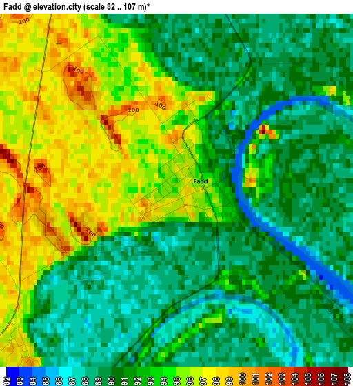
Below is the Elevation map of Fadd, which displays elevation range with different colors. Scale of the first map is from 82 to 107 m (269 to 351 ft) with average elevation of 91.9 meters (=302 ft) [note 1]
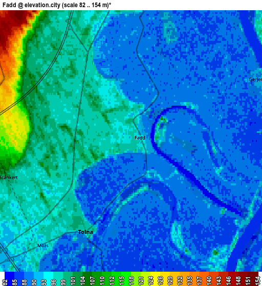
These maps also provides idea of topography and contour of this city, they are displayed at different zoom levels. More info about maps, scale and edge coordinates you can find below images.
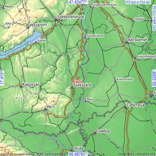
| \ | Map #1 | Map #2 | Topo.Map |
| Scale [m] | 82..107 m | 82..154 m | × |
| Scale [ft] | 269..351 ft | 269..505 ft | × |
| Average | 91.9 m = 302 ft | 93.7 m = 307 ft | × |
| Width | 6.73 km = 4.2 mi | 13.46 km = 8.4 mi | 215.4 km = 133.8 mi |
| Height | 6.73 km = 4.2 mi | 13.46 km = 8.4 mi | 215.4 km = 133.8 mi |
| ↑Max Latitude | 46.495021° | 46.525265° | 47.42477° |
| Latitude at center | 46.46476° | 46.46476° | 46.46476° |
| ↓Min Latitude | 46.434482° | 46.404187° | 45.48751° |
| ← Min Longitude | 18.775305° | 18.731359° | 17.413° |
| Longitude center | 18.81925° | 18.81925° | 18.81925° |
| →Max Longitude | 18.863195° | 18.907141° | 20.2255° |
Nearby cities:
Cities around Fadd sort by population:
• Szekszárd elevation 94 m
15.3 km,  213°
213°
• Paks 71 m
17.7 km,  9°
9°
• Kalocsa 90 m
13.8 km,  58°
58°
• Tolna 100 m
5.1 km, 213°
• Dusnok 91 m
13.7 km,  126°
126°
• Szentgálpuszta 110 m
17.9 km,  235°
235°
• Dunaszentgyörgy 99 m
7.1 km,  359°
359°
• Őcsény 90 m
17.5 km,  195°
195°
• Szedres 106 m
10.5 km,  276°
276°
• Tengelic 123 m
10.9 km,  310°
310°
• Bogyiszló 89 m
8.8 km,  174°
174°
• Bátya 91 m
10.7 km,  75°
75°
Multilingual:
 En español:
Fadd elevación 95 m.
 En France:
Fadd élévation 95 m.


Sources and notes:
- [note 1] Map square and city borders are not equal. Map elevation data is calculated only from area inside that square.
- [src 1] Elevation data from geonames database provided with same terms of usage.
- [src 2] The elevation map of Fadd is generated using elevation data from NASA's 3 arcsec (90m) resolution SRTM data.
- [src 3] Base (background) map © OpenStreetMap contributors tiles are generated by Geofabrik and OpenTopoMap.
Copyright & License:
This Fadd Elevation Map is licensed under CC BY-SA. You may reuse any part from this page, if you give a proper credit by linking to this URL:
 More info on terms of use page.