Paks elevation
Paks (Tolna), Hungary elevation is 71 meters and Paks elevation in feet is 233 ft above sea level [src 1]. Paks is a seat of a second-order administrative division (feature code) with elevation that is 58 meters (190 ft) smaller than average city elevation in Hungary.
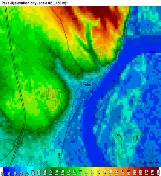
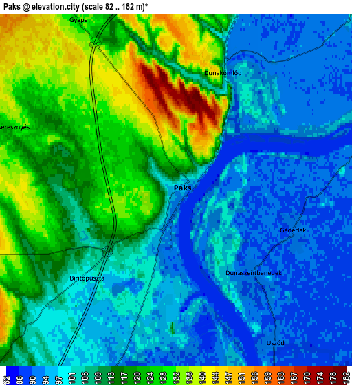
Below is the Elevation map of Paks, which displays elevation range with different colors. Scale of the first map is from 82 to 180 m (269 to 591 ft) with average elevation of 111.6 meters (=366 ft) [note 1]
These maps also provides idea of topography and contour of this city, they are displayed at different zoom levels. More info about maps, scale and edge coordinates you can find below images.
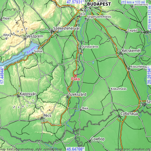
| \ | Map #1 | Map #2 | Topo.Map |
| Scale [m] | 82..180 m | 82..182 m | × |
| Scale [ft] | 269..591 ft | 269..597 ft | × |
| Average | 111.6 m = 366 ft | 108.9 m = 357 ft | × |
| Width | 6.71 km = 4.2 mi | 13.42 km = 8.3 mi | 214.8 km = 133.5 mi |
| Height | 6.71 km = 4.2 mi | 13.42 km = 8.3 mi | 214.8 km = 133.5 mi |
| ↑Max Latitude | 46.652274° | 46.68243° | 47.57931° |
| Latitude at center | 46.6221° | 46.6221° | 46.6221° |
| ↓Min Latitude | 46.59191° | 46.561702° | 45.64766° |
| ← Min Longitude | 18.811745° | 18.767799° | 17.44944° |
| Longitude center | 18.85569° | 18.85569° | 18.85569° |
| →Max Longitude | 18.899635° | 18.943581° | 20.26194° |
Nearby cities:
Cities around Paks sort by population:
• Kalocsa elevation 90 m
13.6 km,  138°
138°
• Fadd 95 m
17.7 km,  189°
189°
• Harta 87 m
15.8 km,  57°
57°
• Dunapataj 94 m
11 km,  77°
77°
• Bölcske 99 m
15.7 km,  32°
32°
• Nagydorog 104 m
15.3 km,  272°
272°
• Dunaszentgyörgy 99 m
10.8 km,  195°
195°
• Szedres 106 m
21 km,  219°
219°
• Tengelic 123 m
15.2 km,  226°
226°
• Bátya 91 m
16.7 km,  153°
153°
• Madocsa 95 m
10.7 km,  46°
46°
• Németkér 148 m
12.6 km,  326°
326°
Multilingual:
 En español:
Paks elevación 71 m.
 En France:
Paks élévation 71 m.


Sources and notes:
- [note 1] Map square and city borders are not equal. Map elevation data is calculated only from area inside that square.
- [src 1] Elevation data from geonames database provided with same terms of usage.
- [src 2] The elevation map of Paks is generated using elevation data from NASA's 3 arcsec (90m) resolution SRTM data.
- [src 3] Base (background) map © OpenStreetMap contributors tiles are generated by Geofabrik and OpenTopoMap.
Copyright & License:
This Paks Elevation Map is licensed under CC BY-SA. You may reuse any part from this page, if you give a proper credit by linking to this URL:
 More info on terms of use page.