Szekszárd elevation
Szekszárd (Tolna), Hungary elevation is 94 meters and Szekszárd elevation in feet is 308 ft above sea level [src 1]. Szekszárd is a seat of a first-order administrative division (feature code) with elevation that is 35 meters (115 ft) smaller than average city elevation in Hungary.
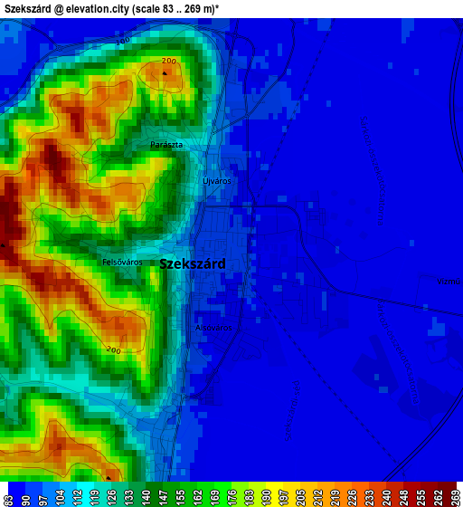
Below is the Elevation map of Szekszárd, which displays elevation range with different colors. Scale of the first map is from 83 to 269 m (272 to 883 ft) with average elevation of 119.8 meters (=393 ft) [note 1]
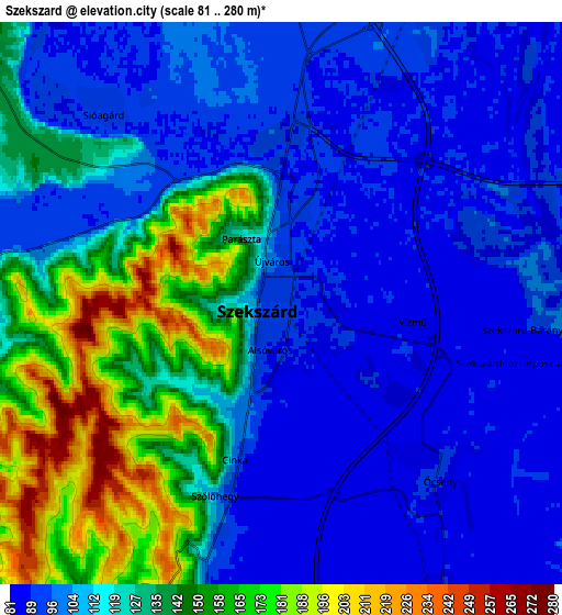
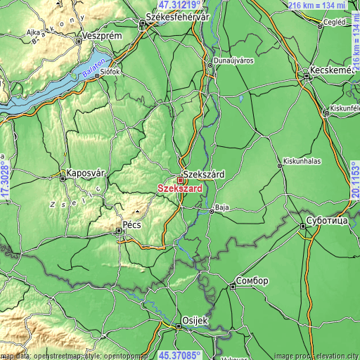
These maps also provides idea of topography and contour of this city, they are displayed at different zoom levels. More info about maps, scale and edge coordinates you can find below images.
| \ | Map #1 | Map #2 | Topo.Map |
| Scale [m] | 83..269 m | 81..280 m | × |
| Scale [ft] | 272..883 ft | 266..919 ft | × |
| Average | 119.8 m = 393 ft | 117.9 m = 387 ft | × |
| Width | 6.75 km = 4.2 mi | 13.49 km = 8.4 mi | 215.9 km = 134.2 mi |
| Height | 6.75 km = 4.2 mi | 13.49 km = 8.4 mi | 215.8 km = 134.1 mi |
| ↑Max Latitude | 46.380465° | 46.410773° | 47.31219° |
| Latitude at center | 46.35014° | 46.35014° | 46.35014° |
| ↓Min Latitude | 46.319798° | 46.28944° | 45.37085° |
| ← Min Longitude | 18.665105° | 18.621159° | 17.3028° |
| Longitude center | 18.70905° | 18.70905° | 18.70905° |
| →Max Longitude | 18.752995° | 18.796941° | 20.1153° |
Nearby cities:
Cities around Szekszárd sort by population:
• Bonyhád elevation 122 m
14.9 km,  247°
247°
• Tolna 100 m
10.2 km,  33°
33°
• Bátaszék 88 m
17.4 km,  176°
176°
• Fadd 95 m
15.3 km, 33°
• Decs 88 m
8.3 km,  151°
151°
• Szentgálpuszta 110 m
6.9 km,  293°
293°
• Őcsény 90 m
5.5 km,  137°
137°
• Szedres 106 m
14.1 km,  351°
351°
• Tengelic 123 m
19.9 km,  0°
0°
• Bogyiszló 89 m
10.1 km,  66°
66°
• Zomba 120 m
12.9 km,  301°
301°
• Hidas 139 m
19.4 km,  237°
237°
Multilingual:
 En español:
Szekszárd elevación 94 m.
 En France:
Szekszárd élévation 94 m.
 Auf Deutsch:
Szekszárd höhe über dem Meeresspiegel ist 94 m.

Sources and notes:
- [note 1] Map square and city borders are not equal. Map elevation data is calculated only from area inside that square.
- [src 1] Elevation data from geonames database provided with same terms of usage.
- [src 2] The elevation map of Szekszárd is generated using elevation data from NASA's 3 arcsec (90m) resolution SRTM data.
- [src 3] Base (background) map © OpenStreetMap contributors tiles are generated by Geofabrik and OpenTopoMap.
Copyright & License:
This Szekszárd Elevation Map is licensed under CC BY-SA. You may reuse any part from this page, if you give a proper credit by linking to this URL:
 More info on terms of use page.