Izsák elevation
Izsák (Bács-Kiskun), Hungary elevation is 101 meters and Izsák elevation in feet is 331 ft above sea level [src 1]. Izsák is a populated place (feature code) with elevation that is 28 meters (92 ft) smaller than average city elevation in Hungary.
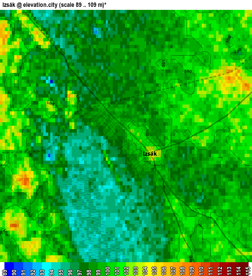
Below is the Elevation map of Izsák, which displays elevation range with different colors. Scale of the first map is from 89 to 109 m (292 to 358 ft) with average elevation of 98.5 meters (=323 ft) [note 1]
These maps also provides idea of topography and contour of this city, they are displayed at different zoom levels. More info about maps, scale and edge coordinates you can find below images.
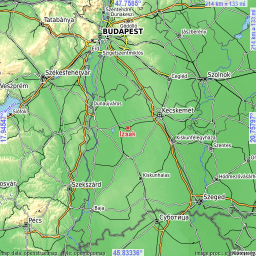
| \ | Map #1 | Map #2 | Topo.Map |
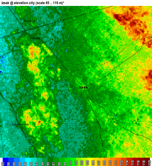
| Scale [m] | 89..109 m | 85..119 m | × |
| Scale [ft] | 292..358 ft | 279..390 ft | × |
| Average | 98.5 m = 323 ft | 99 m = 325 ft | × |
| Width | 6.69 km = 4.2 mi | 13.38 km = 8.3 mi | 214.1 km = 133 mi |
| Height | 6.69 km = 4.2 mi | 13.38 km = 8.3 mi | 214 km = 133 mi |
| ↑Max Latitude | 46.834612° | 46.864667° | 47.7585° |
| Latitude at center | 46.80454° | 46.80454° | 46.80454° |
| ↓Min Latitude | 46.774451° | 46.744346° | 45.83336° |
| ← Min Longitude | 19.307775° | 19.263829° | 17.94547° |
| Longitude center | 19.35172° | 19.35172° | 19.35172° |
| →Max Longitude | 19.395665° | 19.439611° | 20.75797° |
Nearby cities:
Cities around Izsák sort by population:
• Kiskőrös elevation 100 m
21 km,  193°
193°
• Soltvadkert 111 m
25.3 km,  172°
172°
• Solt 87 m
26.7 km,  269°
269°
• Szabadszállás 97 m
12.6 km,  309°
309°
• Kerekegyháza 118 m
17.6 km,  33°
33°
• Helvécia 121 m
20.9 km,  80°
80°
• Akasztó 92 m
16.8 km,  221°
221°
• Orgovány 107 m
11 km,  122°
122°
• Ballószög 121 m
17.9 km,  68°
68°
• Fülöpszállás 96 m
8.9 km,  281°
281°
• Csengőd 96 m
11.8 km,  212°
212°
• Ágasegyháza 105 m
8.6 km,  62°
62°
Multilingual:
 En español:
Izsák elevación 101 m.
 En France:
Izsák élévation 101 m.


Sources and notes:
- [note 1] Map square and city borders are not equal. Map elevation data is calculated only from area inside that square.
- [src 1] Elevation data from geonames database provided with same terms of usage.
- [src 2] The elevation map of Izsák is generated using elevation data from NASA's 3 arcsec (90m) resolution SRTM data.
- [src 3] Base (background) map © OpenStreetMap contributors tiles are generated by Geofabrik and OpenTopoMap.
Copyright & License:
This Izsák Elevation Map is licensed under CC BY-SA. You may reuse any part from this page, if you give a proper credit by linking to this URL:
 More info on terms of use page.