Pannonhalma elevation
Pannonhalma (Győr-Moson-Sopron), Hungary elevation is 170 meters and Pannonhalma elevation in feet is 558 ft above sea level [src 1]. Pannonhalma is a seat of a second-order administrative division (feature code) with elevation that is 41 meters (135 ft) bigger than average city elevation in Hungary.
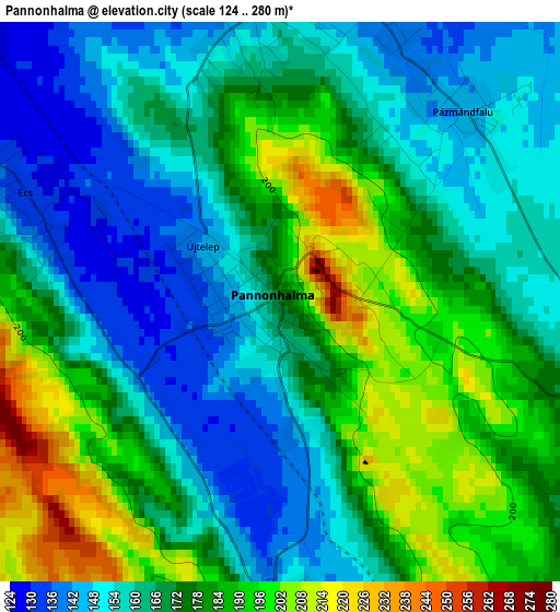
Below is the Elevation map of Pannonhalma, which displays elevation range with different colors. Scale of the first map is from 124 to 280 m (407 to 919 ft) with average elevation of 170.6 meters (=560 ft) [note 1]
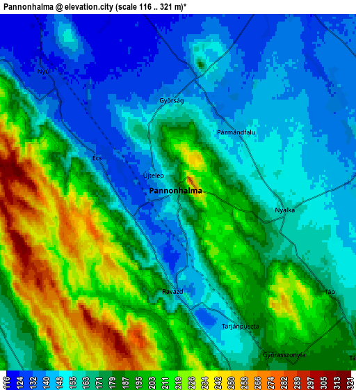
These maps also provides idea of topography and contour of this city, they are displayed at different zoom levels. More info about maps, scale and edge coordinates you can find below images.
| \ | Map #1 | Map #2 | Topo.Map |
| Scale [m] | 124..280 m | 116..321 m | × |
| Scale [ft] | 407..919 ft | 381..1053 ft | × |
| Average | 170.6 m = 560 ft | 175.2 m = 575 ft | × |
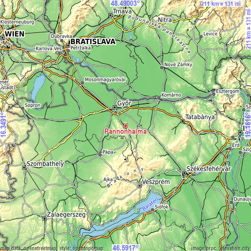
| Width | 6.6 km = 4.1 mi | 13.19 km = 8.2 mi | 211.1 km = 131.2 mi |
| Height | 6.6 km = 4.1 mi | 13.19 km = 8.2 mi | 211.1 km = 131.2 mi |
| ↑Max Latitude | 47.579113° | 47.608749° | 48.49003° |
| Latitude at center | 47.54946° | 47.54946° | 47.54946° |
| ↓Min Latitude | 47.519791° | 47.490104° | 46.5917° |
| ← Min Longitude | 17.711405° | 17.667459° | 16.3491° |
| Longitude center | 17.75535° | 17.75535° | 17.75535° |
| →Max Longitude | 17.799295° | 17.843241° | 19.1616° |
Nearby cities:
Cities around Pannonhalma sort by population:
• Győr elevation 122 m
17.4 km,  328°
328°
• Kisbér 177 m
21.7 km,  103°
103°
• Győrújbarát 124 m
10.2 km,  308°
308°
• Tét 131 m
18.9 km,  259°
259°
• Bábolna 134 m
19.7 km,  57°
57°
• Nyúl 125 m
6.7 km, 312°
• Győrszemere 127 m
14.4 km,  271°
271°
• Rábapatona 111 m
22.6 km,  294°
294°
• Pér 128 m
7.9 km,  28°
28°
• Bőny 125 m
14.1 km,  37°
37°
• Bakonyszentlászló 218 m
18.2 km,  168°
168°
• Töltéstava 121 m
8.7 km,  349°
349°
Multilingual:
 En español:
Pannonhalma elevación 170 m.
 En France:
Pannonhalma élévation 170 m.
 Auf Deutsch:
Sankt Martinsberg höhe über dem Meeresspiegel ist 170 m.

Sources and notes:
- [note 1] Map square and city borders are not equal. Map elevation data is calculated only from area inside that square.
- [src 1] Elevation data from geonames database provided with same terms of usage.
- [src 2] The elevation map of Pannonhalma is generated using elevation data from NASA's 3 arcsec (90m) resolution SRTM data.
- [src 3] Base (background) map © OpenStreetMap contributors tiles are generated by Geofabrik and OpenTopoMap.
Copyright & License:
This Pannonhalma Elevation Map is licensed under CC BY-SA. You may reuse any part from this page, if you give a proper credit by linking to this URL:
 More info on terms of use page.