Tét elevation
Tét (Győr-Moson-Sopron), Hungary elevation is 131 meters and Tét elevation in feet is 430 ft above sea level [src 1]. Tét is a seat of a second-order administrative division (feature code) with elevation that is 2 meters (7 ft) bigger than average city elevation in Hungary.
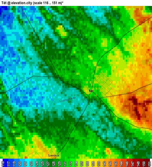
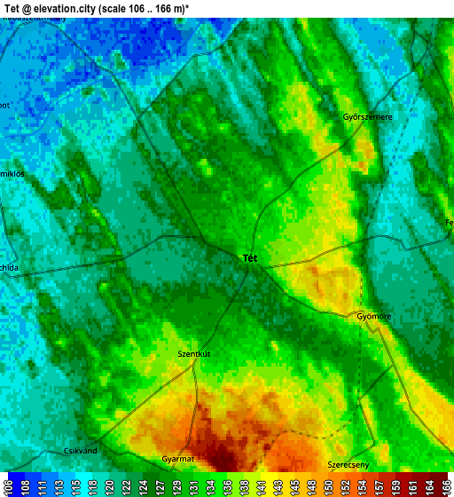
Below is the Elevation map of Tét, which displays elevation range with different colors. Scale of the first map is from 116 to 151 m (381 to 495 ft) with average elevation of 129.5 meters (=425 ft) [note 1]
These maps also provides idea of topography and contour of this city, they are displayed at different zoom levels. More info about maps, scale and edge coordinates you can find below images.
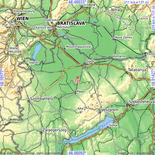
| \ | Map #1 | Map #2 | Topo.Map |
| Scale [m] | 116..151 m | 106..166 m | × |
| Scale [ft] | 381..495 ft | 348..545 ft | × |
| Average | 129.5 m = 425 ft | 127.4 m = 418 ft | × |
| Width | 6.6 km = 4.1 mi | 13.2 km = 8.2 mi | 211.2 km = 131.2 mi |
| Height | 6.6 km = 4.1 mi | 13.2 km = 8.2 mi | 211.2 km = 131.2 mi |
| ↑Max Latitude | 47.54889° | 47.578543° | 48.46033° |
| Latitude at center | 47.51922° | 47.51922° | 47.51922° |
| ↓Min Latitude | 47.489533° | 47.45983° | 46.56092° |
| ← Min Longitude | 17.464075° | 17.420129° | 16.10177° |
| Longitude center | 17.50802° | 17.50802° | 17.50802° |
| →Max Longitude | 17.551965° | 17.595911° | 18.91427° |
Nearby cities:
Cities around Tét sort by population:
• Győr elevation 122 m
20.6 km,  27°
27°
• Pápa 154 m
21.3 km,  188°
188°
• Csorna 118 m
21.9 km,  297°
297°
• Győrújbarát 124 m
14.3 km,  47°
47°
• Pannonhalma 170 m
18.9 km,  79°
79°
• Nyúl 125 m
15.7 km,  59°
59°
• Abda 111 m
19.7 km,  8°
8°
• Győrszemere 127 m
5.6 km, 48°
• Kóny 113 m
16.8 km,  317°
317°
• Rábapatona 111 m
12.7 km,  350°
350°
• Szany 121 m
16.5 km,  248°
248°
• Töltéstava 121 m
20.7 km, 54°
Multilingual:
 En español:
Tét elevación 131 m.
 En France:
Tét élévation 131 m.


Sources and notes:
- [note 1] Map square and city borders are not equal. Map elevation data is calculated only from area inside that square.
- [src 1] Elevation data from geonames database provided with same terms of usage.
- [src 2] The elevation map of Tét is generated using elevation data from NASA's 3 arcsec (90m) resolution SRTM data.
- [src 3] Base (background) map © OpenStreetMap contributors tiles are generated by Geofabrik and OpenTopoMap.
Copyright & License:
This Tét Elevation Map is licensed under CC BY-SA. You may reuse any part from this page, if you give a proper credit by linking to this URL:
 More info on terms of use page.