Otočac elevation
Otočac (Ličko-Senjska), Croatia elevation is 459 meters and Otočac elevation in feet is 1506 ft above sea level [src 1]. Otočac is a seat of a second-order administrative division (feature code) with elevation that is 305 meters (1001 ft) bigger than average city elevation in Croatia.
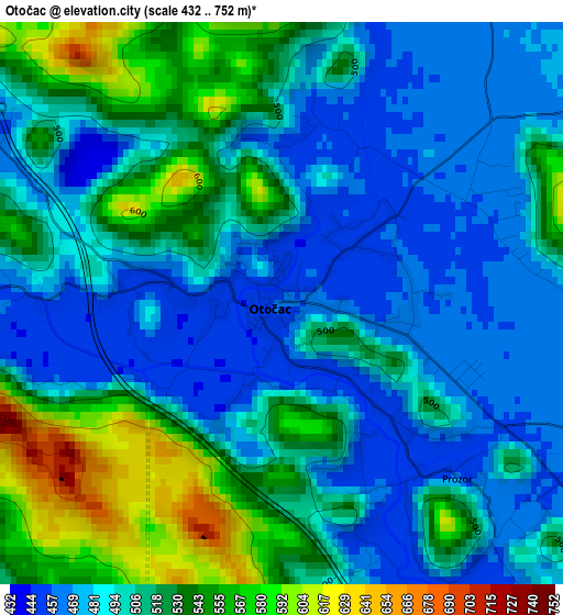
Below is the Elevation map of Otočac, which displays elevation range with different colors. Scale of the first map is from 432 to 752 m (1417 to 2467 ft) with average elevation of 505.6 meters (=1659 ft) [note 1]
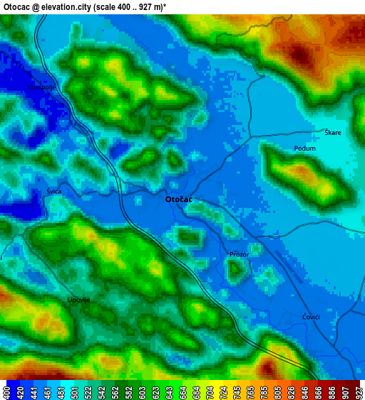
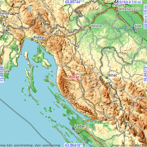
These maps also provides idea of topography and contour of this city, they are displayed at different zoom levels. More info about maps, scale and edge coordinates you can find below images.
| \ | Map #1 | Map #2 | Topo.Map |
| Scale [m] | 432..752 m | 400..927 m | × |
| Scale [ft] | 1417..2467 ft | 1312..3041 ft | × |
| Average | 505.6 m = 1659 ft | 542.4 m = 1780 ft | × |
| Width | 6.93 km = 4.3 mi | 13.85 km = 8.6 mi | 221.6 km = 137.7 mi |
| Height | 6.93 km = 4.3 mi | 13.85 km = 8.6 mi | 221.6 km = 137.7 mi |
| ↑Max Latitude | 44.900576° | 44.931696° | 45.85744° |
| Latitude at center | 44.86944° | 44.86944° | 44.86944° |
| ↓Min Latitude | 44.838287° | 44.807117° | 43.86418° |
| ← Min Longitude | 15.193555° | 15.149609° | 13.83125° |
| Longitude center | 15.2375° | 15.2375° | 15.2375° |
| →Max Longitude | 15.281445° | 15.325391° | 16.64375° |
Nearby cities:
Cities around Otočac sort by population:
• Gospić elevation 563 m
37.6 km,  163°
163°
• Senj 18 m
29.3 km,  297°
297°
• Popovača 601 m
26 km,  190°
190°
• Lički Osik 575 m
33 km,  153°
153°
• Banjol 13 m
38.2 km,  249°
249°
• Brinje 477 m
16.9 km,  331°
331°
• Plaški 377 m
25.2 km,  24°
24°
• Josipdol 343 m
35.3 km,  6°
6°
• Perušić 579 m
27 km, 154°
• Rakovica 348 m
35.3 km,  67°
67°
• Saborsko 612 m
22.8 km,  56°
56°
• Vrhovine 726 m
14.5 km,  97°
97°
Multilingual:
 En español:
Otočac elevación 459 m.
 En France:
Otočac élévation 459 m.


Sources and notes:
- [note 1] Map square and city borders are not equal. Map elevation data is calculated only from area inside that square.
- [src 1] Elevation data from geonames database provided with same terms of usage.
- [src 2] The elevation map of Otočac is generated using elevation data from NASA's 3 arcsec (90m) resolution SRTM data.
- [src 3] Base (background) map © OpenStreetMap contributors tiles are generated by Geofabrik and OpenTopoMap.
Copyright & License:
This Otočac Elevation Map is licensed under CC BY-SA. You may reuse any part from this page, if you give a proper credit by linking to this URL:
 More info on terms of use page.