Popovača elevation
Popovača (Ličko-Senjska), Croatia elevation is 601 meters and Popovača elevation in feet is 1972 ft above sea level [src 1]. Popovača is a populated locality (feature code) with elevation that is 447 meters (1467 ft) bigger than average city elevation in Croatia.
Below is the Elevation map of Popovača, which displays elevation range with different colors. Scale of the first map is from 573 to 1241 m (1880 to 4072 ft) with average elevation of 703.3 meters (=2307 ft) [note 1]
These maps also provides idea of topography and contour of this city, they are displayed at different zoom levels. More info about maps, scale and edge coordinates you can find below images.
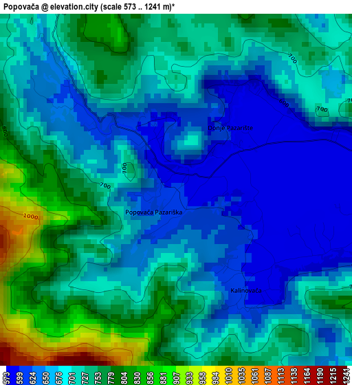
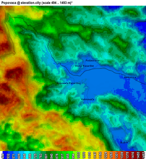
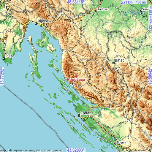
| \ | Map #1 | Map #2 | Topo.Map |
| Scale [m] | 573..1241 m | 494..1493 m | × |
| Scale [ft] | 1880..4072 ft | 1621..4898 ft | × |
| Average | 703.3 m = 2307 ft | 850.2 m = 2789 ft | × |
| Width | 6.95 km = 4.3 mi | 13.91 km = 8.6 mi | 222.5 km = 138.3 mi |
| Height | 6.95 km = 4.3 mi | 13.91 km = 8.6 mi | 222.5 km = 138.3 mi |
| ↑Max Latitude | 44.670431° | 44.701675° | 45.63115° |
| Latitude at center | 44.63917° | 44.63917° | 44.63917° |
| ↓Min Latitude | 44.607892° | 44.576598° | 43.62993° |
| ← Min Longitude | 15.135225° | 15.091279° | 13.77292° |
| Longitude center | 15.17917° | 15.17917° | 15.17917° |
| →Max Longitude | 15.223115° | 15.267061° | 16.58542° |
Nearby cities:
Cities around Popovača sort by population:
• Gospić elevation 563 m
18.6 km,  123°
123°
• Otočac 459 m
26 km,  10°
10°
• Pag 18 m
23.6 km,  204°
204°
• Novalja 17 m
24.9 km,  248°
248°
• Lički Osik 575 m
19.8 km,  101°
101°
• Banjol 13 m
33.6 km,  291°
291°
• Stari Grad 18 m
25 km, 201°
• Karlobag 30 m
15 km,  213°
213°
• Perušić 579 m
16.2 km,  85°
85°
• Povljana 31 m
32.9 km,  188°
188°
• Vrhovine 726 m
30.3 km,  38°
38°
• Kolan 113 m
23.6 km,  226°
226°
Multilingual:
 En español:
Popovača elevación 601 m.
 En France:
Popovača élévation 601 m.
 Auf Deutsch:
Popovača höhe über dem Meeresspiegel ist 601 m.

Sources and notes:
- [note 1] Map square and city borders are not equal. Map elevation data is calculated only from area inside that square.
- [src 1] Elevation data from geonames database provided with same terms of usage.
- [src 2] The elevation map of Popovača is generated using elevation data from NASA's 3 arcsec (90m) resolution SRTM data.
- [src 3] Base (background) map © OpenStreetMap contributors tiles are generated by Geofabrik and OpenTopoMap.
Copyright & License:
This Popovača Elevation Map is licensed under CC BY-SA. You may reuse any part from this page, if you give a proper credit by linking to this URL:
 More info on terms of use page.