Taulabé elevation
Taulabé (Comayagua), Honduras elevation is 571 meters and Taulabé elevation in feet is 1873 ft above sea level [src 1]. Taulabé is a populated place (feature code) with elevation that is 28 meters (92 ft) bigger than average city elevation in Honduras.
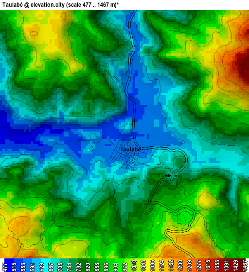
Below is the Elevation map of Taulabé, which displays elevation range with different colors. Scale of the first map is from 477 to 1467 m (1565 to 4813 ft) with average elevation of 819.7 meters (=2689 ft) [note 1]
These maps also provides idea of topography and contour of this city, they are displayed at different zoom levels. More info about maps, scale and edge coordinates you can find below images.
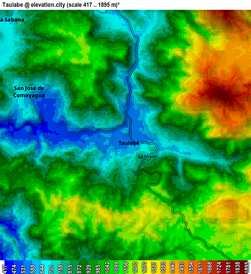
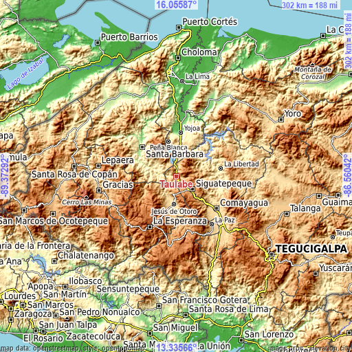
| \ | Map #1 | Map #2 | Topo.Map |
| Scale [m] | 477..1467 m | 417..1895 m | × |
| Scale [ft] | 1565..4813 ft | 1368..6217 ft | × |
| Average | 819.7 m = 2689 ft | 978.6 m = 3211 ft | × |
| Width | 9.45 km = 5.9 mi | 18.91 km = 11.8 mi | 302.5 km = 188 mi |
| Height | 9.45 km = 5.9 mi | 18.91 km = 11.8 mi | 302.5 km = 188 mi |
| ↑Max Latitude | 14.742503° | 14.784997° | 16.05587° |
| Latitude at center | 14.7° | 14.7° | 14.7° |
| ↓Min Latitude | 14.657489° | 14.61497° | 13.33566° |
| ← Min Longitude | -88.010615° | -88.054561° | -89.37292° |
| Longitude center | -87.96667° | -87.96667° | -87.96667° |
| →Max Longitude | -87.922725° | -87.878779° | -86.56042° |
Nearby cities:
Cities around Taulabé sort by population:
• Siguatepeque elevation 1079 m
18.1 km,  127°
127°
• El Rincón 1231 m
13.5 km,  164°
164°
• El Porvenir 1157 m
15.8 km,  145°
145°
• Potrerillos 1274 m
19.8 km, 147°
• Azacualpa 373 m
14.5 km,  277°
277°
• Cerro Blanco 1189 m
20.1 km,  100°
100°
• Ojos de Agua 1122 m
11.7 km, 162°
• Aguas del Padre 1249 m
17.3 km, 148°
• El Socorro 1134 m
9.2 km,  144°
144°
• San José de Comayagua 716 m
8.1 km,  297°
297°
• San Pedro Zacapa 335 m
17.1 km,  289°
289°
• Río Bonito 1522 m
11.6 km,  50°
50°
Multilingual:
 En español:
Taulabé elevación 571 m.
 En France:
Taulabé élévation 571 m.


Sources and notes:
- [note 1] Map square and city borders are not equal. Map elevation data is calculated only from area inside that square.
- [src 1] Elevation data from geonames database provided with same terms of usage.
- [src 2] The elevation map of Taulabé is generated using elevation data from NASA's 3 arcsec (90m) resolution SRTM data.
- [src 3] Base (background) map © OpenStreetMap contributors tiles are generated by Geofabrik and OpenTopoMap.
Copyright & License:
This Taulabé Elevation Map is licensed under CC BY-SA. You may reuse any part from this page, if you give a proper credit by linking to this URL:
 More info on terms of use page.