Grappenhall elevation
Grappenhall (England, Warrington), United Kingdom elevation is 36 meters and Grappenhall elevation in feet is 118 ft above sea level [src 1]. Grappenhall is a populated place (feature code) with elevation that is 36 meters (118 ft) smaller than average city elevation in United Kingdom.
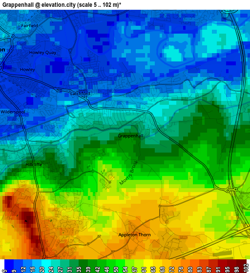
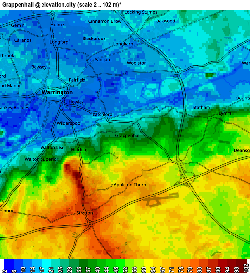
Below is the Elevation map of Grappenhall, which displays elevation range with different colors. Scale of the first map is from 5 to 102 m (16 to 335 ft) with average elevation of 36.6 meters (=120 ft) [note 1]
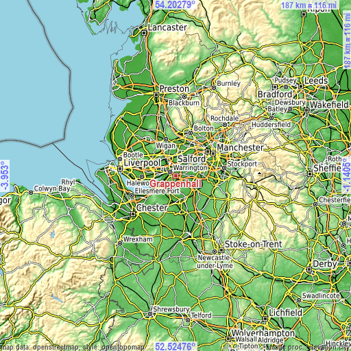
These maps also provides idea of topography and contour of this city, they are displayed at different zoom levels. More info about maps, scale and edge coordinates you can find below images.
| \ | Map #1 | Map #2 | Topo.Map |
| Scale [m] | 5..102 m | 2..102 m | × |
| Scale [ft] | 16..335 ft | 7..335 ft | × |
| Average | 36.6 m = 120 ft | 38.3 m = 126 ft | × |
| Width | 5.83 km = 3.6 mi | 11.66 km = 7.2 mi | 186.6 km = 115.9 mi |
| Height | 5.83 km = 3.6 mi | 11.66 km = 7.2 mi | 186.6 km = 115.9 mi |
| ↑Max Latitude | 53.39825° | 53.424445° | 54.20279° |
| Latitude at center | 53.37204° | 53.37204° | 53.37204° |
| ↓Min Latitude | 53.345813° | 53.319571° | 52.52476° |
| ← Min Longitude | -2.590695° | -2.634641° | -3.953° |
| Longitude center | -2.54675° | -2.54675° | -2.54675° |
| →Max Longitude | -2.502805° | -2.458859° | -1.1405° |
Nearby cities:
Cities around Grappenhall sort by population:
• Warrington elevation 15 m
3.2 km,  315°
315°
• Great Sankey 17 m
6.6 km,  290°
290°
• Lymm 29 m
4.7 km,  77°
77°
• Culcheth 32 m
9 km,  10°
10°
• Stockton Heath 21 m
1.8 km,  265°
265°
• Daresbury 72 m
6.8 km,  240°
240°
• Winwick 31 m
7.7 km,  332°
332°
• Croft 20 m
6.8 km,  358°
358°
• Appleton Thorn 76 m
2.4 km,  177°
177°
• High Legh 81 m
6.6 km,  110°
110°
• Stretton 80 m
4.5 km,  197°
197°
• Appleton 72 m
2.7 km,  217°
217°
Multilingual:
 En español:
Grappenhall elevación 36 m.
 En France:
Grappenhall élévation 36 m.
 Auf Deutsch:
Grappenhall höhe über dem Meeresspiegel ist 36 m.

Sources and notes:
- [note 1] Map square and city borders are not equal. Map elevation data is calculated only from area inside that square.
- [src 1] Elevation data from geonames database provided with same terms of usage.
- [src 2] The elevation map of Grappenhall is generated using elevation data from NASA's 3 arcsec (90m) resolution SRTM data.
- [src 3] Base (background) map © OpenStreetMap contributors tiles are generated by Geofabrik and OpenTopoMap.
Copyright & License:
This Grappenhall Elevation Map is licensed under CC BY-SA. You may reuse any part from this page, if you give a proper credit by linking to this URL:
 More info on terms of use page.