High Legh elevation
High Legh (England, Cheshire East), United Kingdom elevation is 81 meters and High Legh elevation in feet is 266 ft above sea level [src 1]. High Legh is a populated place (feature code) with elevation that is 9 meters (30 ft) bigger than average city elevation in United Kingdom.
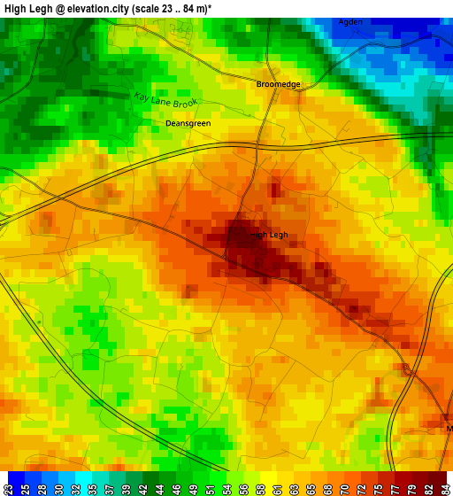
Below is the Elevation map of High Legh, which displays elevation range with different colors. Scale of the first map is from 23 to 84 m (75 to 276 ft) with average elevation of 58.7 meters (=193 ft) [note 1]
These maps also provides idea of topography and contour of this city, they are displayed at different zoom levels. More info about maps, scale and edge coordinates you can find below images.
| \ | Map #1 | Topo.Map |
| Scale [m] | 23..84 m | × |
| Scale [ft] | 75..276 ft | × |
| Average | 58.7 m = 193 ft | × |
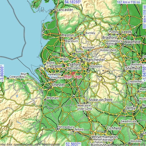
| Width | 5.83 km = 3.6 mi | 186.7 km = 116 mi |
| Height | 5.83 km = 3.6 mi | 186.7 km = 116 mi |
| ↑Max Latitude | 53.377613° | 54.18255° |
| Latitude at center | 53.35139° | 53.35139° |
| ↓Min Latitude | 53.325151° | 52.5037° |
| ← Min Longitude | -2.497745° | -3.86005° |
| Longitude center | -2.4538° | -2.4538° |
| →Max Longitude | -2.409855° | -1.04755° |
Nearby cities:
Cities around High Legh sort by population:
• Altrincham elevation 42 m
8.1 km,  60°
60°
• Knutsford 68 m
7.5 km,  135°
135°
• Lymm 29 m
3.7 km,  334°
334°
• Grappenhall 36 m
6.6 km,  290°
290°
• Partington 20 m
7.7 km,  12°
12°
• Stockton Heath 21 m
8.3 km, 285°
• Bowdon 58 m
6.5 km, 64°
• Appleton Thorn 76 m
6 km,  269°
269°
• Ashley 46 m
8 km,  91°
91°
• Appleton 72 m
7.8 km, 270°
• Stretton 80 m
7.8 km,  254°
254°
• Mere 72 m
3.6 km,  126°
126°
Multilingual:
 En español:
High Legh elevación 81 m.
 En France:
High Legh élévation 81 m.
 Auf Deutsch:
High Legh höhe über dem Meeresspiegel ist 81 m.

Sources and notes:
- [note 1] Map square and city borders are not equal. Map elevation data is calculated only from area inside that square.
- [src 1] Elevation data from geonames database provided with same terms of usage.
- [src 2] The elevation map of High Legh is generated using elevation data from NASA's 3 arcsec (90m) resolution SRTM data.
- [src 3] Base (background) map © OpenStreetMap contributors tiles are generated by Geofabrik and OpenTopoMap.
Copyright & License:
This High Legh Elevation Map is licensed under CC BY-SA. You may reuse any part from this page, if you give a proper credit by linking to this URL:
 More info on terms of use page.