Daresbury elevation
Daresbury (England, Borough of Halton), United Kingdom elevation is 72 meters and Daresbury elevation in feet is 236 ft above sea level [src 1]. Daresbury is a seat of a third-order administrative division (feature code) with elevation that is 0 meters (0 ft) bigger than average city elevation in United Kingdom.
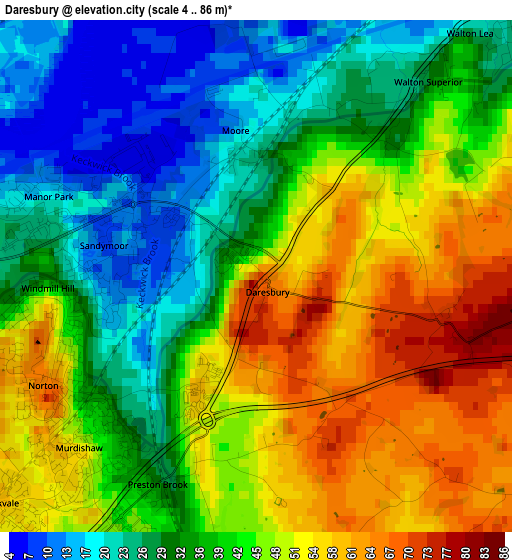
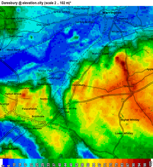
Below is the Elevation map of Daresbury, which displays elevation range with different colors. Scale of the first map is from 4 to 86 m (13 to 282 ft) with average elevation of 40.8 meters (=134 ft) [note 1]
These maps also provides idea of topography and contour of this city, they are displayed at different zoom levels. More info about maps, scale and edge coordinates you can find below images.
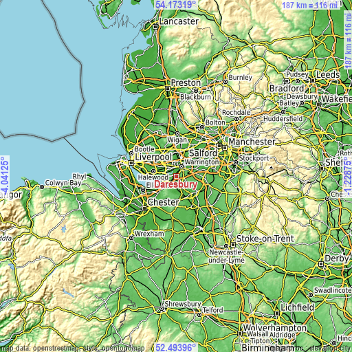
| \ | Map #1 | Map #2 | Topo.Map |
| Scale [m] | 4..86 m | 2..102 m | × |
| Scale [ft] | 13..282 ft | 7..335 ft | × |
| Average | 40.8 m = 134 ft | 38.2 m = 125 ft | × |
| Width | 5.83 km = 3.6 mi | 11.67 km = 7.3 mi | 186.7 km = 116 mi |
| Height | 5.83 km = 3.6 mi | 11.67 km = 7.3 mi | 186.7 km = 116 mi |
| ↑Max Latitude | 53.368069° | 53.394282° | 54.17319° |
| Latitude at center | 53.34184° | 53.34184° | 53.34184° |
| ↓Min Latitude | 53.315595° | 53.289334° | 52.49396° |
| ← Min Longitude | -2.678945° | -2.722891° | -4.04125° |
| Longitude center | -2.635° | -2.635° | -2.635° |
| →Max Longitude | -2.591055° | -2.547109° | -1.22875° |
Nearby cities:
Cities around Daresbury sort by population:
• Warrington elevation 15 m
6.7 km,  32°
32°
• Runcorn 18 m
6.4 km,  269°
269°
• Widnes 13 m
6.9 km,  288°
288°
• Great Sankey 17 m
5.6 km,  356°
356°
• Grappenhall 36 m
6.8 km,  60°
60°
• Frodsham 14 m
8.1 km,  229°
229°
• Stockton Heath 21 m
5.2 km,  51°
51°
• Halton 50 m
5.1 km,  237°
237°
• Kingsley 42 m
8.6 km,  194°
194°
• Appleton Thorn 76 m
6.1 km,  80°
80°
• Stretton 80 m
4.6 km,  101°
101°
• Appleton 72 m
4.4 km,  74°
74°
Multilingual:
 En español:
Daresbury elevación 72 m.
 En France:
Daresbury élévation 72 m.
 Auf Deutsch:
Daresbury höhe über dem Meeresspiegel ist 72 m.

Sources and notes:
- [note 1] Map square and city borders are not equal. Map elevation data is calculated only from area inside that square.
- [src 1] Elevation data from geonames database provided with same terms of usage.
- [src 2] The elevation map of Daresbury is generated using elevation data from NASA's 3 arcsec (90m) resolution SRTM data.
- [src 3] Base (background) map © OpenStreetMap contributors tiles are generated by Geofabrik and OpenTopoMap.
Copyright & License:
This Daresbury Elevation Map is licensed under CC BY-SA. You may reuse any part from this page, if you give a proper credit by linking to this URL:
 More info on terms of use page.