Runcorn elevation
Runcorn (England, Borough of Halton), United Kingdom elevation is 18 meters and Runcorn elevation in feet is 59 ft above sea level [src 1]. Runcorn is a populated place (feature code) with elevation that is 54 meters (177 ft) smaller than average city elevation in United Kingdom.
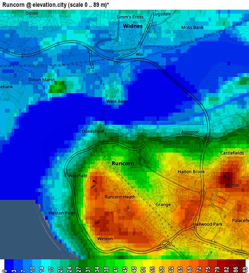
Below is the Elevation map of Runcorn, which displays elevation range with different colors. Scale of the first map is from 0 to 89 m (0 to 292 ft) with average elevation of 26 meters (=85 ft) [note 1]
These maps also provides idea of topography and contour of this city, they are displayed at different zoom levels. More info about maps, scale and edge coordinates you can find below images.

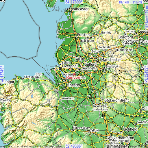
| \ | Map #1 | Map #2 | Topo.Map |
| Scale [m] | 0..89 m | 0..89 m | × |
| Scale [ft] | 0..292 ft | 0..292 ft | × |
| Average | 26 m = 85 ft | 23.3 m = 76 ft | × |
| Width | 5.83 km = 3.6 mi | 11.67 km = 7.3 mi | 186.7 km = 116 mi |
| Height | 5.83 km = 3.6 mi | 11.67 km = 7.3 mi | 186.7 km = 116 mi |
| ↑Max Latitude | 53.367969° | 53.394182° | 54.17309° |
| Latitude at center | 53.34174° | 53.34174° | 53.34174° |
| ↓Min Latitude | 53.315495° | 53.289233° | 52.49386° |
| ← Min Longitude | -2.775185° | -2.819131° | -4.13749° |
| Longitude center | -2.73124° | -2.73124° | -2.73124° |
| →Max Longitude | -2.687295° | -2.643349° | -1.32499° |
Nearby cities:
Cities around Runcorn sort by population:
• Widnes elevation 13 m
2.2 km,  355°
355°
• Great Sankey 17 m
8.3 km,  47°
47°
• Frodsham 14 m
5.2 km,  177°
177°
• Helsby 19 m
7.9 km,  198°
198°
• Daresbury 72 m
6.4 km,  89°
89°
• Halton 50 m
3.5 km,  143°
143°
• Hale 16 m
4.7 km,  258°
258°
• Kingsley 42 m
9.4 km,  152°
152°
• Appleton 72 m
10.6 km,  83°
83°
• Elton 13 m
10.1 km,  214°
214°
• Whiston 62 m
9.5 km,  336°
336°
• Ince 23 m
9.4 km,  226°
226°
Multilingual:
 En español:
Runcorn elevación 18 m.
 En France:
Runcorn élévation 18 m.


Sources and notes:
- [note 1] Map square and city borders are not equal. Map elevation data is calculated only from area inside that square.
- [src 1] Elevation data from geonames database provided with same terms of usage.
- [src 2] The elevation map of Runcorn is generated using elevation data from NASA's 3 arcsec (90m) resolution SRTM data.
- [src 3] Base (background) map © OpenStreetMap contributors tiles are generated by Geofabrik and OpenTopoMap.
Copyright & License:
This Runcorn Elevation Map is licensed under CC BY-SA. You may reuse any part from this page, if you give a proper credit by linking to this URL:
 More info on terms of use page.