Alston elevation
Alston (England, Cumbria), United Kingdom elevation is 298 meters and Alston elevation in feet is 978 ft above sea level [src 1]. Alston is a populated place (feature code) with elevation that is 226 meters (741 ft) bigger than average city elevation in United Kingdom.
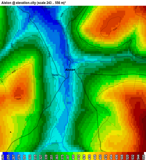
Below is the Elevation map of Alston, which displays elevation range with different colors. Scale of the first map is from 243 to 556 m (797 to 1824 ft) with average elevation of 378.8 meters (=1243 ft) [note 1]
These maps also provides idea of topography and contour of this city, they are displayed at different zoom levels. More info about maps, scale and edge coordinates you can find below images.
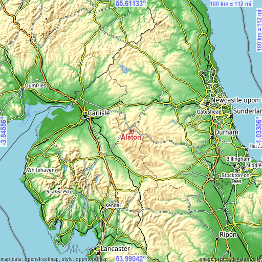
| \ | Map #1 | Topo.Map |
| Scale [m] | 243..556 m | × |
| Scale [ft] | 797..1824 ft | × |
| Average | 378.8 m = 1243 ft | × |
| Width | 5.63 km = 3.5 mi | 180.2 km = 112 mi |
| Height | 5.63 km = 3.5 mi | 180.2 km = 112 mi |
| ↑Max Latitude | 54.834318° | 55.61133° |
| Latitude at center | 54.809° | 54.809° |
| ↓Min Latitude | 54.783666° | 53.99042° |
| ← Min Longitude | -2.483255° | -3.84556° |
| Longitude center | -2.43931° | -2.43931° |
| →Max Longitude | -2.395365° | -1.03306° |
Nearby cities:
Cities around Alston sort by population:
• Penrith elevation 146 m
25.9 km,  232°
232°
• Hexham 61 m
27.9 km,  50°
50°
• Brampton 72 m
24.5 km,  309°
309°
• Haltwhistle 124 m
18 km,  356°
356°
• Appleby-in-Westmorland 140 m
26 km,  187°
187°
• Wetheral 58 m
26.6 km,  288°
288°
• Haydon Bridge 65 m
22.2 km,  33°
33°
• Warden 45 m
27.5 km, 45°
• Holwick 271 m
27 km,  135°
135°
• Newbiggin 251 m
27 km,  133°
133°
• Bardon Mill 100 m
19.5 km,  18°
18°
• Greenhead 180 m
18.2 km,  344°
344°
Multilingual:
 En español:
Alston elevación 298 m.
 En France:
Alston élévation 298 m.


Sources and notes:
- [note 1] Map square and city borders are not equal. Map elevation data is calculated only from area inside that square.
- [src 1] Elevation data from geonames database provided with same terms of usage.
- [src 2] The elevation map of Alston is generated using elevation data from NASA's 3 arcsec (90m) resolution SRTM data.
- [src 3] Base (background) map © OpenStreetMap contributors tiles are generated by Geofabrik and OpenTopoMap.
Copyright & License:
This Alston Elevation Map is licensed under CC BY-SA. You may reuse any part from this page, if you give a proper credit by linking to this URL:
 More info on terms of use page.