Barnoldswick elevation
Barnoldswick (England, Lancashire), United Kingdom elevation is 161 meters and Barnoldswick elevation in feet is 528 ft above sea level [src 1]. Barnoldswick is a populated place (feature code) with elevation that is 89 meters (292 ft) bigger than average city elevation in United Kingdom.
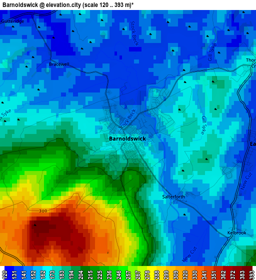
Below is the Elevation map of Barnoldswick, which displays elevation range with different colors. Scale of the first map is from 120 to 393 m (394 to 1289 ft) with average elevation of 186.2 meters (=611 ft) [note 1]
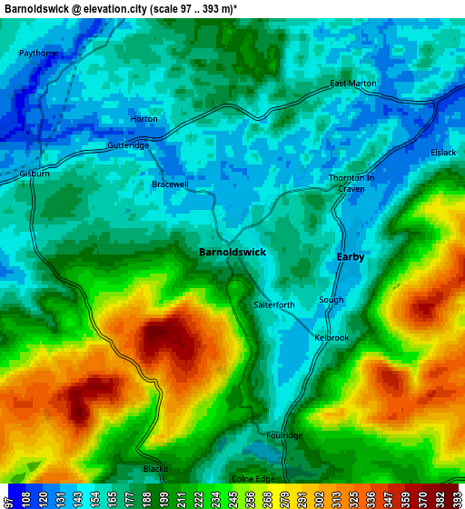
These maps also provides idea of topography and contour of this city, they are displayed at different zoom levels. More info about maps, scale and edge coordinates you can find below images.
| \ | Map #1 | Map #2 | Topo.Map |
| Scale [m] | 120..393 m | 97..393 m | × |
| Scale [ft] | 394..1289 ft | 318..1289 ft | × |
| Average | 186.2 m = 611 ft | 198.6 m = 652 ft | × |
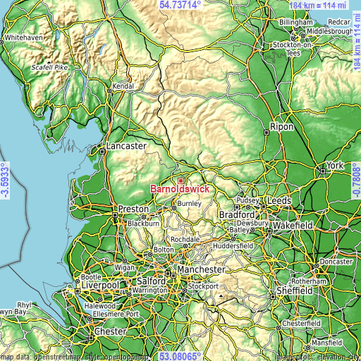
| Width | 5.76 km = 3.6 mi | 11.51 km = 7.2 mi | 184.2 km = 114.5 mi |
| Height | 5.76 km = 3.6 mi | 11.51 km = 7.2 mi | 184.2 km = 114.5 mi |
| ↑Max Latitude | 53.942984° | 53.968842° | 54.73714° |
| Latitude at center | 53.91711° | 53.91711° | 53.91711° |
| ↓Min Latitude | 53.89122° | 53.865314° | 53.08065° |
| ← Min Longitude | -2.230995° | -2.274941° | -3.5933° |
| Longitude center | -2.18705° | -2.18705° | -2.18705° |
| →Max Longitude | -2.143105° | -2.099159° | -0.7808° |
Nearby cities:
Cities around Barnoldswick sort by population:
• Nelson elevation 170 m
9.4 km,  185°
185°
• Colne 191 m
6.8 km,  169°
169°
• Skipton 113 m
12.2 km,  66°
66°
• Brierfield 156 m
10.7 km,  196°
196°
• Glusburn 116 m
12.4 km,  98°
98°
• Barrowford 117 m
8.1 km, 194°
• Earby 138 m
2.9 km,  93°
93°
• Gargrave 112 m
9.1 km,  36°
36°
• Hellifield 146 m
10 km,  346°
346°
• Low Bradley 118 m
12.6 km,  82°
82°
• Foulridge 176 m
4.8 km, 165°
• Chatburn 99 m
11.3 km,  255°
255°
Multilingual:
 En español:
Barnoldswick elevación 161 m.
 En France:
Barnoldswick élévation 161 m.
 Auf Deutsch:
Barnoldswick höhe über dem Meeresspiegel ist 161 m.

Sources and notes:
- [note 1] Map square and city borders are not equal. Map elevation data is calculated only from area inside that square.
- [src 1] Elevation data from geonames database provided with same terms of usage.
- [src 2] The elevation map of Barnoldswick is generated using elevation data from NASA's 3 arcsec (90m) resolution SRTM data.
- [src 3] Base (background) map © OpenStreetMap contributors tiles are generated by Geofabrik and OpenTopoMap.
Copyright & License:
This Barnoldswick Elevation Map is licensed under CC BY-SA. You may reuse any part from this page, if you give a proper credit by linking to this URL:
 More info on terms of use page.