Barnsley elevation
Barnsley (England), United Kingdom elevation is 112 meters and Barnsley elevation in feet is 367 ft above sea level [src 1]. Barnsley is a seat of a second-order administrative division (feature code) with elevation that is 40 meters (131 ft) bigger than average city elevation in United Kingdom.
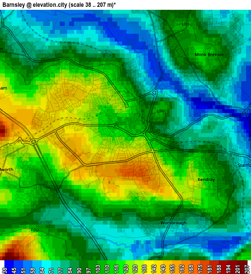
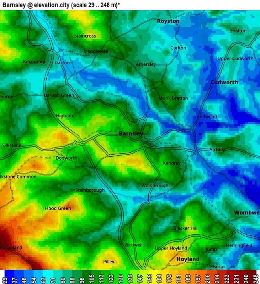
Below is the Elevation map of Barnsley, which displays elevation range with different colors. Scale of the first map is from 38 to 207 m (125 to 679 ft) with average elevation of 98.3 meters (=323 ft) [note 1]
These maps also provides idea of topography and contour of this city, they are displayed at different zoom levels. More info about maps, scale and edge coordinates you can find below images.
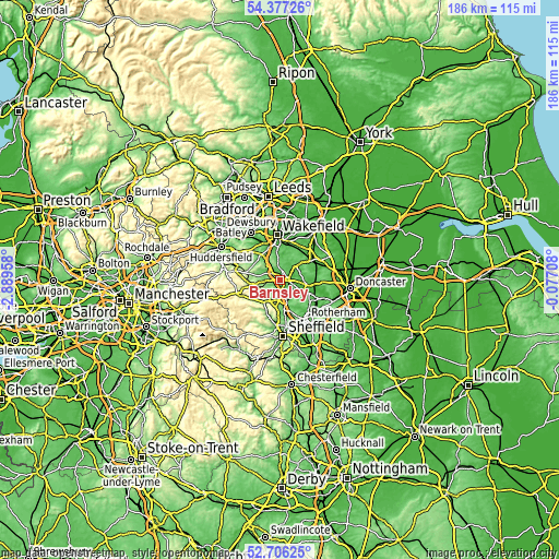
| \ | Map #1 | Map #2 | Topo.Map |
| Scale [m] | 38..207 m | 29..248 m | × |
| Scale [ft] | 125..679 ft | 95..814 ft | × |
| Average | 98.3 m = 323 ft | 99.7 m = 327 ft | × |
| Width | 5.81 km = 3.6 mi | 11.61 km = 7.2 mi | 185.8 km = 115.5 mi |
| Height | 5.81 km = 3.6 mi | 11.61 km = 7.2 mi | 185.8 km = 115.5 mi |
| ↑Max Latitude | 53.576101° | 53.602185° | 54.37726° |
| Latitude at center | 53.55° | 53.55° | 53.55° |
| ↓Min Latitude | 53.523883° | 53.49775° | 52.70625° |
| ← Min Longitude | -1.527275° | -1.571221° | -2.88958° |
| Longitude center | -1.48333° | -1.48333° | -1.48333° |
| →Max Longitude | -1.439385° | -1.395439° | -0.07708° |
Nearby cities:
Cities around Barnsley sort by population:
• Hoyland Nether elevation 162 m
6 km,  158°
158°
• Wombwell 53 m
6.5 km,  118°
118°
• Darton 69 m
5 km,  325°
325°
• Cudworth 68 m
5 km,  61°
61°
• Royston 69 m
6 km,  21°
21°
• Dodworth 141 m
3 km,  255°
255°
• Birdwell 126 m
4 km,  176°
176°
• Silkstone 114 m
5.3 km,  267°
267°
• Cawthorne 104 m
6.2 km,  287°
287°
• Notton 55 m
7 km,  5°
5°
• Shafton 82 m
6.8 km,  45°
45°
• Stainborough 157 m
3.5 km,  220°
220°
Multilingual:
 En español:
Barnsley elevación 112 m.
 En France:
Barnsley élévation 112 m.
 Auf Deutsch:
Barnsley höhe über dem Meeresspiegel ist 112 m.

Sources and notes:
- [note 1] Map square and city borders are not equal. Map elevation data is calculated only from area inside that square.
- [src 1] Elevation data from geonames database provided with same terms of usage.
- [src 2] The elevation map of Barnsley is generated using elevation data from NASA's 3 arcsec (90m) resolution SRTM data.
- [src 3] Base (background) map © OpenStreetMap contributors tiles are generated by Geofabrik and OpenTopoMap.
Copyright & License:
This Barnsley Elevation Map is licensed under CC BY-SA. You may reuse any part from this page, if you give a proper credit by linking to this URL:
 More info on terms of use page.