Cawthorne elevation
Cawthorne (England, Barnsley), United Kingdom elevation is 104 meters and Cawthorne elevation in feet is 341 ft above sea level [src 1]. Cawthorne is a seat of a third-order administrative division (feature code) with elevation that is 32 meters (105 ft) bigger than average city elevation in United Kingdom.
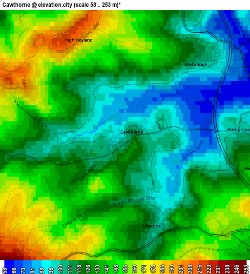
Below is the Elevation map of Cawthorne, which displays elevation range with different colors. Scale of the first map is from 58 to 253 m (190 to 830 ft) with average elevation of 129.6 meters (=425 ft) [note 1]
These maps also provides idea of topography and contour of this city, they are displayed at different zoom levels. More info about maps, scale and edge coordinates you can find below images.
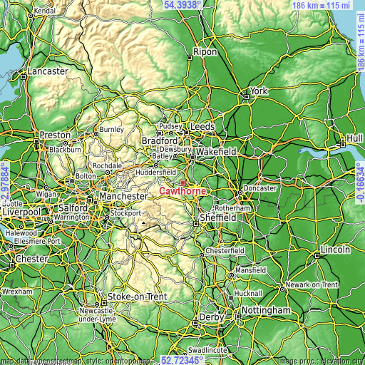
| \ | Map #1 | Topo.Map |
| Scale [m] | 58..253 m | × |
| Scale [ft] | 190..830 ft | × |
| Average | 129.6 m = 425 ft | × |
| Width | 5.8 km = 3.6 mi | 185.7 km = 115.4 mi |
| Height | 5.8 km = 3.6 mi | 185.7 km = 115.4 mi |
| ↑Max Latitude | 53.59296° | 54.3938° |
| Latitude at center | 53.56687° | 53.56687° |
| ↓Min Latitude | 53.540764° | 52.72345° |
| ← Min Longitude | -1.616535° | -2.97884° |
| Longitude center | -1.57259° | -1.57259° |
| →Max Longitude | -1.528645° | -0.16634° |
Nearby cities:
Cities around Cawthorne sort by population:
• Barnsley elevation 112 m
6.2 km,  107°
107°
• Darton 69 m
3.8 km,  53°
53°
• Penistone 231 m
6 km,  219°
219°
• Clayton West 127 m
4 km,  320°
320°
• Dodworth 141 m
4 km,  131°
131°
• Shelley 217 m
8.2 km,  296°
296°
• Denby Dale 166 m
5.7 km,  276°
276°
• Silkstone 114 m
2.2 km,  164°
164°
• Emley 192 m
6.5 km, 323°
• Notton 55 m
8.3 km, 52°
• Woolley 117 m
6.4 km,  36°
36°
• Stainborough 157 m
5.8 km,  141°
141°
Multilingual:
 En español:
Cawthorne elevación 104 m.
 En France:
Cawthorne élévation 104 m.
 Auf Deutsch:
Cawthorne höhe über dem Meeresspiegel ist 104 m.

Sources and notes:
- [note 1] Map square and city borders are not equal. Map elevation data is calculated only from area inside that square.
- [src 1] Elevation data from geonames database provided with same terms of usage.
- [src 2] The elevation map of Cawthorne is generated using elevation data from NASA's 3 arcsec (90m) resolution SRTM data.
- [src 3] Base (background) map © OpenStreetMap contributors tiles are generated by Geofabrik and OpenTopoMap.
Copyright & License:
This Cawthorne Elevation Map is licensed under CC BY-SA. You may reuse any part from this page, if you give a proper credit by linking to this URL:
 More info on terms of use page.