Berkhamsted elevation
Berkhamsted (England, Hertfordshire), United Kingdom elevation is 113 meters and Berkhamsted elevation in feet is 371 ft above sea level [src 1]. Berkhamsted is a populated place (feature code) with elevation that is 41 meters (135 ft) bigger than average city elevation in United Kingdom.
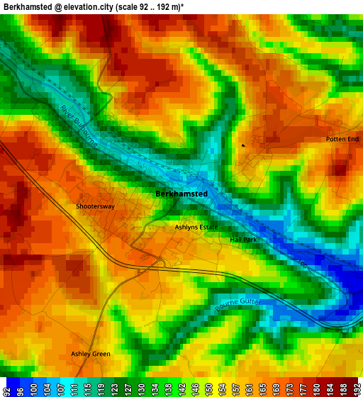
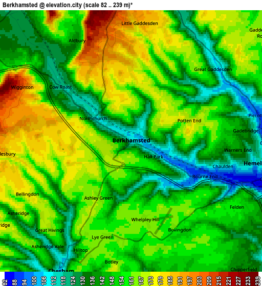
Below is the Elevation map of Berkhamsted, which displays elevation range with different colors. Scale of the first map is from 92 to 192 m (302 to 630 ft) with average elevation of 148.5 meters (=487 ft) [note 1]
These maps also provides idea of topography and contour of this city, they are displayed at different zoom levels. More info about maps, scale and edge coordinates you can find below images.
| \ | Map #1 | Map #2 | Topo.Map |
| Scale [m] | 92..192 m | 82..239 m | × |
| Scale [ft] | 302..630 ft | 269..784 ft | × |
| Average | 148.5 m = 487 ft | 153.5 m = 504 ft | × |
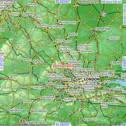
| Width | 6.05 km = 3.8 mi | 12.1 km = 7.5 mi | 193.6 km = 120.3 mi |
| Height | 6.05 km = 3.8 mi | 12.1 km = 7.5 mi | 193.5 km = 120.2 mi |
| ↑Max Latitude | 51.787592° | 51.814767° | 52.62243° |
| Latitude at center | 51.7604° | 51.7604° | 51.7604° |
| ↓Min Latitude | 51.733192° | 51.705967° | 50.88159° |
| ← Min Longitude | -0.609225° | -0.653171° | -1.97153° |
| Longitude center | -0.56528° | -0.56528° | -0.56528° |
| →Max Longitude | -0.521335° | -0.477389° | 0.84097° |
Nearby cities:
Cities around Berkhamsted sort by population:
• Hemel Hempstead elevation 138 m
8 km,  95°
95°
• Amersham 95 m
11 km,  198°
198°
• Chesham 147 m
7.1 km, 199°
• Amersham on the Hill 152 m
10 km, 196°
• Tring 134 m
7.4 km,  300°
300°
• Kings Langley 93 m
9.4 km,  123°
123°
• Bovingdon 160 m
4.6 km,  154°
154°
• Little Chalfont 133 m
10.2 km,  181°
181°
• Pitstone 115 m
9.1 km,  325°
325°
• Ivinghoe 120 m
9.5 km, 332°
• Kensworth 188 m
11 km,  22°
22°
• Hyde Heath 169 m
9.7 km,  219°
219°
Multilingual:
 En español:
Berkhamsted elevación 113 m.
 En France:
Berkhamsted élévation 113 m.
 Auf Deutsch:
Berkhamsted höhe über dem Meeresspiegel ist 113 m.

Sources and notes:
- [note 1] Map square and city borders are not equal. Map elevation data is calculated only from area inside that square.
- [src 1] Elevation data from geonames database provided with same terms of usage.
- [src 2] The elevation map of Berkhamsted is generated using elevation data from NASA's 3 arcsec (90m) resolution SRTM data.
- [src 3] Base (background) map © OpenStreetMap contributors tiles are generated by Geofabrik and OpenTopoMap.
Copyright & License:
This Berkhamsted Elevation Map is licensed under CC BY-SA. You may reuse any part from this page, if you give a proper credit by linking to this URL:
 More info on terms of use page.