Tring elevation
Tring (England, Hertfordshire), United Kingdom elevation is 134 meters and Tring elevation in feet is 440 ft above sea level [src 1]. Tring is a populated place (feature code) with elevation that is 62 meters (203 ft) bigger than average city elevation in United Kingdom.
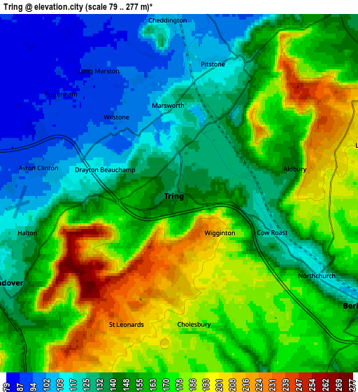
Below is the Elevation map of Tring, which displays elevation range with different colors. Scale of the first map is from 90 to 274 m (295 to 899 ft) with average elevation of 157.6 meters (=517 ft) [note 1]
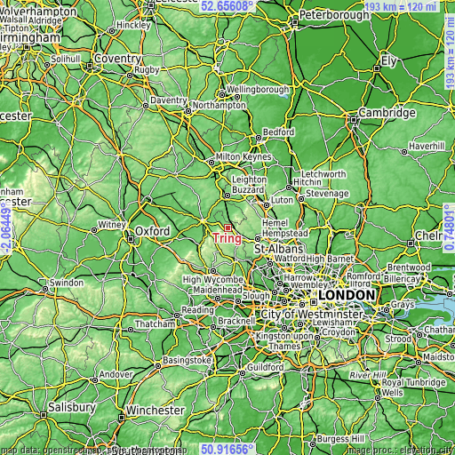
These maps also provides idea of topography and contour of this city, they are displayed at different zoom levels. More info about maps, scale and edge coordinates you can find below images.

| \ | Map #1 | Map #2 | Topo.Map |
| Scale [m] | 90..274 m | 79..277 m | × |
| Scale [ft] | 295..899 ft | 259..909 ft | × |
| Average | 157.6 m = 517 ft | 152.9 m = 502 ft | × |
| Width | 6.04 km = 3.8 mi | 12.09 km = 7.5 mi | 193.4 km = 120.2 mi |
| Height | 6.04 km = 3.8 mi | 12.09 km = 7.5 mi | 193.4 km = 120.2 mi |
| ↑Max Latitude | 51.821881° | 51.849036° | 52.65608° |
| Latitude at center | 51.79471° | 51.79471° | 51.79471° |
| ↓Min Latitude | 51.767522° | 51.740319° | 50.91656° |
| ← Min Longitude | -0.702185° | -0.746131° | -2.06449° |
| Longitude center | -0.65824° | -0.65824° | -0.65824° |
| →Max Longitude | -0.614295° | -0.570349° | 0.74801° |
Nearby cities:
Cities around Tring sort by population:
• Aylesbury elevation 93 m
11 km,  282°
282°
• Berkhamsted 113 m
7.4 km,  120°
120°
• Chesham 147 m
11.3 km,  159°
159°
• Wendover 131 m
6.7 km,  237°
237°
• Great Missenden 132 m
10.6 km,  198°
198°
• Aston Clinton 100 m
4.7 km, 277°
• Eaton Bray 102 m
10.2 km,  26°
26°
• Pitstone 115 m
3.9 km,  18°
18°
• Ivinghoe 120 m
5 km, 23°
• Weston Turville 99 m
6.8 km,  267°
267°
• Cheddington 107 m
5.9 km,  355°
355°
• Wingrave 131 m
9.7 km,  323°
323°
Multilingual:
 En español:
Tring elevación 134 m.
 En France:
Tring élévation 134 m.


Sources and notes:
- [note 1] Map square and city borders are not equal. Map elevation data is calculated only from area inside that square.
- [src 1] Elevation data from geonames database provided with same terms of usage.
- [src 2] The elevation map of Tring is generated using elevation data from NASA's 3 arcsec (90m) resolution SRTM data.
- [src 3] Base (background) map © OpenStreetMap contributors tiles are generated by Geofabrik and OpenTopoMap.
Copyright & License:
This Tring Elevation Map is licensed under CC BY-SA. You may reuse any part from this page, if you give a proper credit by linking to this URL:
 More info on terms of use page.