Billericay elevation
Billericay (England, Essex), United Kingdom elevation is 87 meters and Billericay elevation in feet is 285 ft above sea level [src 1]. Billericay is a populated place (feature code) with elevation that is 15 meters (49 ft) bigger than average city elevation in United Kingdom.
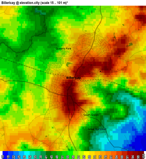
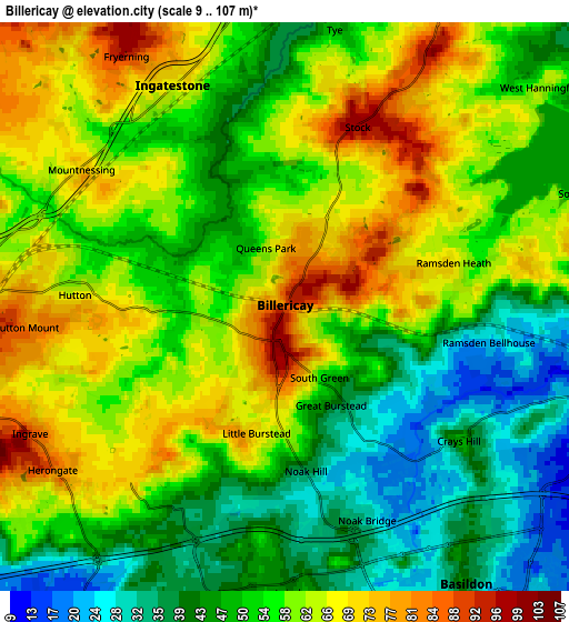
Below is the Elevation map of Billericay, which displays elevation range with different colors. Scale of the first map is from 15 to 101 m (49 to 331 ft) with average elevation of 62.2 meters (=204 ft) [note 1]
These maps also provides idea of topography and contour of this city, they are displayed at different zoom levels. More info about maps, scale and edge coordinates you can find below images.
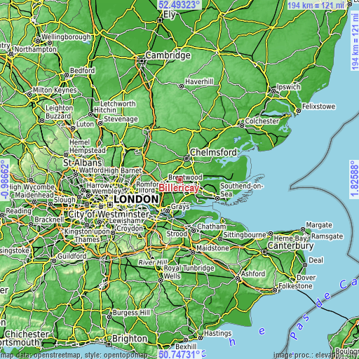
| \ | Map #1 | Map #2 | Topo.Map |
| Scale [m] | 15..101 m | 9..107 m | × |
| Scale [ft] | 49..331 ft | 30..351 ft | × |
| Average | 62.2 m = 204 ft | 55.5 m = 182 ft | × |
| Width | 6.07 km = 3.8 mi | 12.13 km = 7.5 mi | 194.1 km = 120.6 mi |
| Height | 6.07 km = 3.8 mi | 12.13 km = 7.5 mi | 194.1 km = 120.6 mi |
| ↑Max Latitude | 51.655941° | 51.683196° | 52.49323° |
| Latitude at center | 51.62867° | 51.62867° | 51.62867° |
| ↓Min Latitude | 51.601383° | 51.574079° | 50.74731° |
| ← Min Longitude | 0.375685° | 0.331739° | -0.98662° |
| Longitude center | 0.41963° | 0.41963° | 0.41963° |
| →Max Longitude | 0.463575° | 0.507521° | 1.82588° |
Nearby cities:
Cities around Billericay sort by population:
• Basildon elevation 31 m
7.2 km,  158°
158°
• Brentwood 108 m
7.9 km,  264°
264°
• Wickford 8 m
7.4 km,  105°
105°
• Stanford-le-Hope 13 m
11.8 km,  175°
175°
• Pitsea 22 m
9.5 km,  139°
139°
• Ingatestone 64 m
5.3 km,  331°
331°
• Writtle 38 m
11.2 km,  3°
3°
• Kelvedon Hatch 103 m
11.3 km,  292°
292°
• Ingrave 90 m
6.1 km,  243°
243°
• Horndon on the Hill 39 m
11.7 km, 184°
• Stock 97 m
4.2 km,  22°
22°
• Bulphan 8 m
10 km,  203°
203°
Multilingual:
 En español:
Billericay elevación 87 m.
 En France:
Billericay élévation 87 m.
 Auf Deutsch:
Billericay höhe über dem Meeresspiegel ist 87 m.

Sources and notes:
- [note 1] Map square and city borders are not equal. Map elevation data is calculated only from area inside that square.
- [src 1] Elevation data from geonames database provided with same terms of usage.
- [src 2] The elevation map of Billericay is generated using elevation data from NASA's 3 arcsec (90m) resolution SRTM data.
- [src 3] Base (background) map © OpenStreetMap contributors tiles are generated by Geofabrik and OpenTopoMap.
Copyright & License:
This Billericay Elevation Map is licensed under CC BY-SA. You may reuse any part from this page, if you give a proper credit by linking to this URL:
 More info on terms of use page.