Ingrave elevation
Ingrave (England, Essex), United Kingdom elevation is 90 meters and Ingrave elevation in feet is 295 ft above sea level [src 1]. Ingrave is a populated place (feature code) with elevation that is 18 meters (59 ft) bigger than average city elevation in United Kingdom.
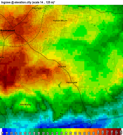
Below is the Elevation map of Ingrave, which displays elevation range with different colors. Scale of the first map is from 14 to 125 m (46 to 410 ft) with average elevation of 72.4 meters (=238 ft) [note 1]
These maps also provides idea of topography and contour of this city, they are displayed at different zoom levels. More info about maps, scale and edge coordinates you can find below images.
| \ | Map #1 | Topo.Map |
| Scale [m] | 14..125 m | × |
| Scale [ft] | 46..410 ft | × |
| Average | 72.4 m = 238 ft | × |
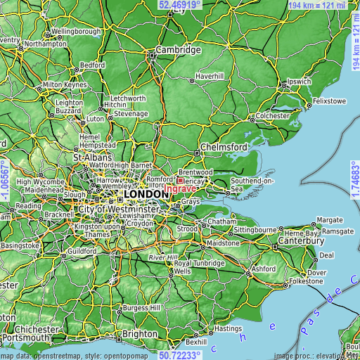
| Width | 6.07 km = 3.8 mi | 194.2 km = 120.7 mi |
| Height | 6.07 km = 3.8 mi | 194.2 km = 120.7 mi |
| ↑Max Latitude | 51.631446° | 52.46919° |
| Latitude at center | 51.60416° | 51.60416° |
| ↓Min Latitude | 51.576858° | 50.72233° |
| ← Min Longitude | 0.296635° | -1.06567° |
| Longitude center | 0.34058° | 0.34058° |
| →Max Longitude | 0.384525° | 1.74683° |
Nearby cities:
Cities around Ingrave sort by population:
• Basildon elevation 31 m
9 km,  116°
116°
• Brentwood 108 m
3.1 km,  308°
308°
• Billericay 87 m
6.1 km,  63°
63°
• Hornchurch 27 m
10.1 km,  238°
238°
• Harold Wood 34 m
7.5 km,  261°
261°
• Upminster 19 m
8 km,  227°
227°
• Ingatestone 64 m
7.9 km,  21°
21°
• Cranham 23 m
6.7 km, 230°
• Kelvedon Hatch 103 m
8.6 km,  324°
324°
• Horndon on the Hill 39 m
10 km,  153°
153°
• Stock 97 m
9.7 km,  46°
46°
• Bulphan 8 m
6.6 km,  167°
167°
Multilingual:
 En español:
Ingrave elevación 90 m.
 En France:
Ingrave élévation 90 m.


Sources and notes:
- [note 1] Map square and city borders are not equal. Map elevation data is calculated only from area inside that square.
- [src 1] Elevation data from geonames database provided with same terms of usage.
- [src 2] The elevation map of Ingrave is generated using elevation data from NASA's 3 arcsec (90m) resolution SRTM data.
- [src 3] Base (background) map © OpenStreetMap contributors tiles are generated by Geofabrik and OpenTopoMap.
Copyright & License:
This Ingrave Elevation Map is licensed under CC BY-SA. You may reuse any part from this page, if you give a proper credit by linking to this URL:
 More info on terms of use page.