Writtle elevation
Writtle (England, Essex), United Kingdom elevation is 38 meters and Writtle elevation in feet is 125 ft above sea level [src 1]. Writtle is a populated place (feature code) with elevation that is 34 meters (112 ft) smaller than average city elevation in United Kingdom.
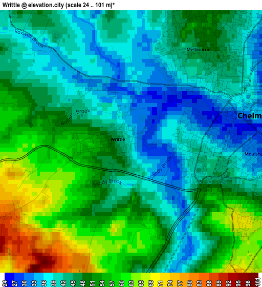
Below is the Elevation map of Writtle, which displays elevation range with different colors. Scale of the first map is from 24 to 101 m (79 to 331 ft) with average elevation of 47.2 meters (=155 ft) [note 1]
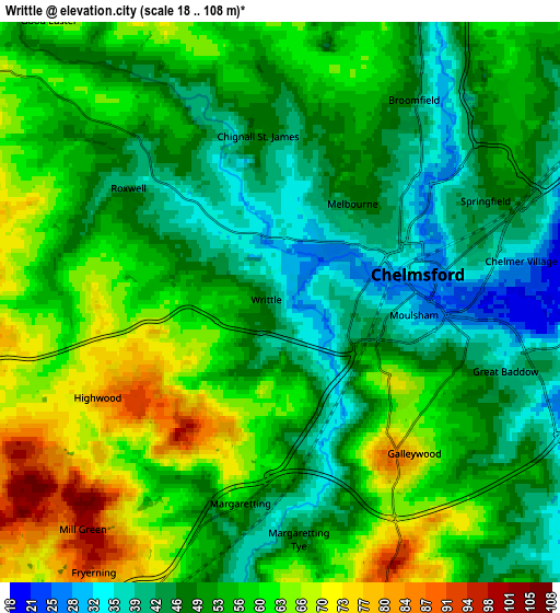
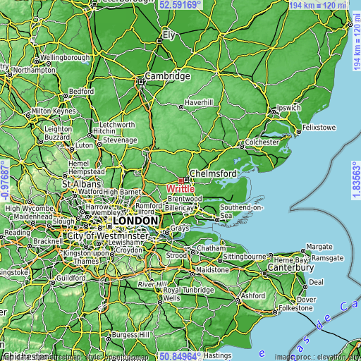
These maps also provides idea of topography and contour of this city, they are displayed at different zoom levels. More info about maps, scale and edge coordinates you can find below images.
| \ | Map #1 | Map #2 | Topo.Map |
| Scale [m] | 24..101 m | 18..108 m | × |
| Scale [ft] | 79..331 ft | 59..354 ft | × |
| Average | 47.2 m = 155 ft | 53.5 m = 176 ft | × |
| Width | 6.05 km = 3.8 mi | 12.11 km = 7.5 mi | 193.7 km = 120.4 mi |
| Height | 6.05 km = 3.8 mi | 12.11 km = 7.5 mi | 193.7 km = 120.4 mi |
| ↑Max Latitude | 51.756271° | 51.783465° | 52.59169° |
| Latitude at center | 51.72906° | 51.72906° | 51.72906° |
| ↓Min Latitude | 51.701833° | 51.674589° | 50.84964° |
| ← Min Longitude | 0.385435° | 0.341489° | -0.97687° |
| Longitude center | 0.42938° | 0.42938° | 0.42938° |
| →Max Longitude | 0.473325° | 0.517271° | 1.83563° |
Nearby cities:
Cities around Writtle sort by population:
• Chelmsford elevation 33 m
2.9 km,  74°
74°
• Billericay 87 m
11.2 km,  183°
183°
• Danbury 106 m
10.6 km,  97°
97°
• Chipping Ongar 55 m
13 km,  257°
257°
• Ingatestone 64 m
7.3 km,  205°
205°
• Hatfield Peverel 46 m
12.5 km, 65°
• Boreham 37 m
8.4 km, 66°
• Bicknacre 51 m
11.4 km,  109°
109°
• Great Leighs 66 m
12.2 km,  25°
25°
• Kelvedon Hatch 103 m
13.1 km,  238°
238°
• Stock 97 m
7.3 km,  172°
172°
• High Ongar 49 m
11.7 km, 259°
Multilingual:
 En español:
Writtle elevación 38 m.
 En France:
Writtle élévation 38 m.


Sources and notes:
- [note 1] Map square and city borders are not equal. Map elevation data is calculated only from area inside that square.
- [src 1] Elevation data from geonames database provided with same terms of usage.
- [src 2] The elevation map of Writtle is generated using elevation data from NASA's 3 arcsec (90m) resolution SRTM data.
- [src 3] Base (background) map © OpenStreetMap contributors tiles are generated by Geofabrik and OpenTopoMap.
Copyright & License:
This Writtle Elevation Map is licensed under CC BY-SA. You may reuse any part from this page, if you give a proper credit by linking to this URL:
 More info on terms of use page.