Bloxham elevation
Bloxham (England, Oxfordshire), United Kingdom elevation is 112 meters and Bloxham elevation in feet is 367 ft above sea level [src 1]. Bloxham is a populated place (feature code) with elevation that is 40 meters (131 ft) bigger than average city elevation in United Kingdom.
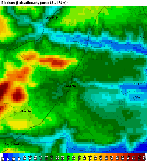
Below is the Elevation map of Bloxham, which displays elevation range with different colors. Scale of the first map is from 88 to 178 m (289 to 584 ft) with average elevation of 120.8 meters (=396 ft) [note 1]
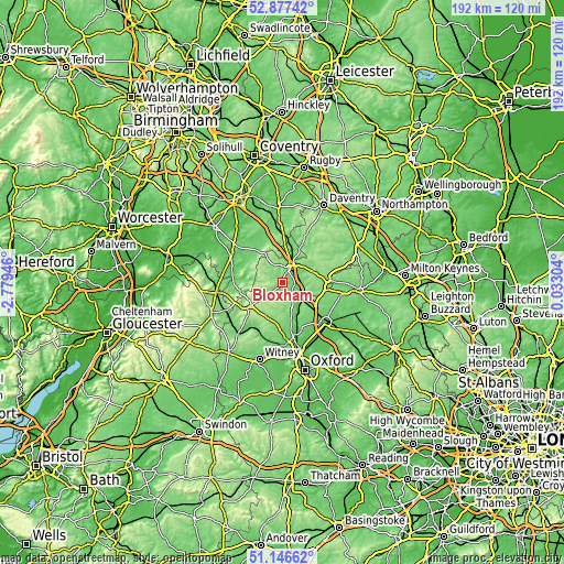
These maps also provides idea of topography and contour of this city, they are displayed at different zoom levels. More info about maps, scale and edge coordinates you can find below images.
| \ | Map #1 | Topo.Map |
| Scale [m] | 88..178 m | × |
| Scale [ft] | 289..584 ft | × |
| Average | 120.8 m = 396 ft | × |
| Width | 6.01 km = 3.7 mi | 192.4 km = 119.6 mi |
| Height | 6.01 km = 3.7 mi | 192.4 km = 119.6 mi |
| ↑Max Latitude | 52.047425° | 52.87742° |
| Latitude at center | 52.02039° | 52.02039° |
| ↓Min Latitude | 51.993339° | 51.14662° |
| ← Min Longitude | -1.417155° | -2.77946° |
| Longitude center | -1.37321° | -1.37321° |
| →Max Longitude | -1.329265° | 0.03304° |
Nearby cities:
Cities around Bloxham sort by population:
• Banbury elevation 100 m
5.2 km,  24°
24°
• Brackley 145 m
15.3 km,  84°
84°
• Chipping Norton 205 m
14.7 km,  233°
233°
• Somerton 112 m
9.9 km,  137°
137°
• Claydon 137 m
14.5 km,  10°
10°
• Adderbury 104 m
4.2 km,  95°
95°
• Farnborough 155 m
13.6 km,  1°
1°
• Kings Sutton 90 m
6.6 km,  87°
87°
• Kineton 91 m
17.8 km,  328°
328°
• Hook Norton 158 m
8 km,  249°
249°
• Deddington 128 m
5.7 km, 140°
• Lower Brailes 109 m
12 km,  286°
286°
Multilingual:
 En español:
Bloxham elevación 112 m.
 En France:
Bloxham élévation 112 m.


Sources and notes:
- [note 1] Map square and city borders are not equal. Map elevation data is calculated only from area inside that square.
- [src 1] Elevation data from geonames database provided with same terms of usage.
- [src 2] The elevation map of Bloxham is generated using elevation data from NASA's 3 arcsec (90m) resolution SRTM data.
- [src 3] Base (background) map © OpenStreetMap contributors tiles are generated by Geofabrik and OpenTopoMap.
Copyright & License:
This Bloxham Elevation Map is licensed under CC BY-SA. You may reuse any part from this page, if you give a proper credit by linking to this URL:
 More info on terms of use page.