Hook Norton elevation
Hook Norton (England, Oxfordshire), United Kingdom elevation is 158 meters and Hook Norton elevation in feet is 518 ft above sea level [src 1]. Hook Norton is a populated place (feature code) with elevation that is 86 meters (282 ft) bigger than average city elevation in United Kingdom.
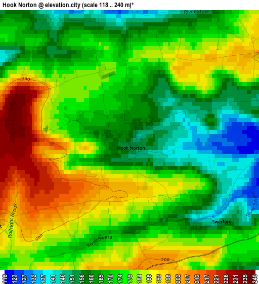
Below is the Elevation map of Hook Norton, which displays elevation range with different colors. Scale of the first map is from 118 to 240 m (387 to 787 ft) with average elevation of 175.4 meters (=575 ft) [note 1]
These maps also provides idea of topography and contour of this city, they are displayed at different zoom levels. More info about maps, scale and edge coordinates you can find below images.
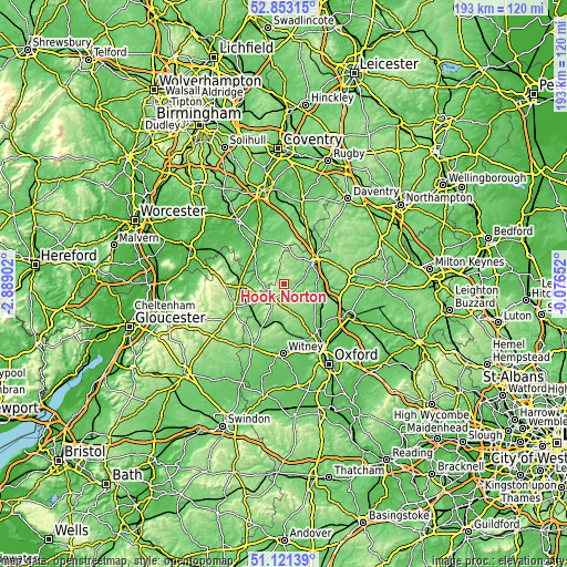
| \ | Map #1 | Topo.Map |
| Scale [m] | 118..240 m | × |
| Scale [ft] | 387..787 ft | × |
| Average | 175.4 m = 575 ft | × |
| Width | 6.02 km = 3.7 mi | 192.6 km = 119.7 mi |
| Height | 6.02 km = 3.7 mi | 192.5 km = 119.6 mi |
| ↑Max Latitude | 52.02269° | 52.85315° |
| Latitude at center | 51.99564° | 51.99564° |
| ↓Min Latitude | 51.968574° | 51.12139° |
| ← Min Longitude | -1.526715° | -2.88902° |
| Longitude center | -1.48277° | -1.48277° |
| →Max Longitude | -1.438825° | -0.07652° |
Nearby cities:
Cities around Hook Norton sort by population:
• Banbury elevation 100 m
12.2 km,  52°
52°
• Chipping Norton 205 m
7.4 km,  215°
215°
• Shipston on Stour 72 m
12.3 km,  306°
306°
• Somerton 112 m
14.9 km,  108°
108°
• Moreton in Marsh 129 m
15.1 km,  267°
267°
• Bloxham 112 m
8 km,  69°
69°
• Charlbury 111 m
13.7 km,  179°
179°
• Adderbury 104 m
11.9 km,  78°
78°
• Kings Sutton 90 m
14.5 km, 77°
• Deddington 128 m
11.2 km,  98°
98°
• Stonesfield 122 m
16.4 km,  167°
167°
• Lower Brailes 109 m
7.3 km,  326°
326°
Multilingual:
 En español:
Hook Norton elevación 158 m.
 En France:
Hook Norton élévation 158 m.
 Auf Deutsch:
Hook Norton höhe über dem Meeresspiegel ist 158 m.

Sources and notes:
- [note 1] Map square and city borders are not equal. Map elevation data is calculated only from area inside that square.
- [src 1] Elevation data from geonames database provided with same terms of usage.
- [src 2] The elevation map of Hook Norton is generated using elevation data from NASA's 3 arcsec (90m) resolution SRTM data.
- [src 3] Base (background) map © OpenStreetMap contributors tiles are generated by Geofabrik and OpenTopoMap.
Copyright & License:
This Hook Norton Elevation Map is licensed under CC BY-SA. You may reuse any part from this page, if you give a proper credit by linking to this URL:
 More info on terms of use page.