Brixworth elevation
Brixworth (England, Northamptonshire), United Kingdom elevation is 125 meters and Brixworth elevation in feet is 410 ft above sea level [src 1]. Brixworth is a populated place (feature code) with elevation that is 53 meters (174 ft) bigger than average city elevation in United Kingdom.
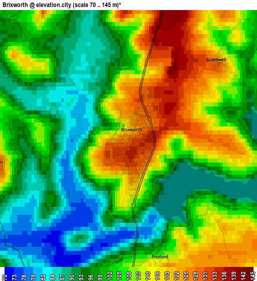
Below is the Elevation map of Brixworth, which displays elevation range with different colors. Scale of the first map is from 70 to 145 m (230 to 476 ft) with average elevation of 103.4 meters (=339 ft) [note 1]
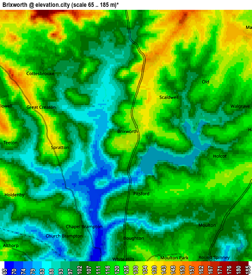
These maps also provides idea of topography and contour of this city, they are displayed at different zoom levels. More info about maps, scale and edge coordinates you can find below images.
| \ | Map #1 | Map #2 | Topo.Map |
| Scale [m] | 70..145 m | 65..185 m | × |
| Scale [ft] | 230..476 ft | 213..607 ft | × |
| Average | 103.4 m = 339 ft | 110.6 m = 363 ft | × |
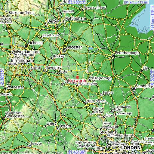
| Width | 5.97 km = 3.7 mi | 11.94 km = 7.4 mi | 191.1 km = 118.7 mi |
| Height | 5.97 km = 3.7 mi | 11.94 km = 7.4 mi | 191.1 km = 118.7 mi |
| ↑Max Latitude | 52.355968° | 52.3828° | 53.18019° |
| Latitude at center | 52.32912° | 52.32912° | 52.32912° |
| ↓Min Latitude | 52.302256° | 52.275375° | 51.46136° |
| ← Min Longitude | -0.947445° | -0.991391° | -2.30975° |
| Longitude center | -0.9035° | -0.9035° | -0.9035° |
| →Max Longitude | -0.859555° | -0.815609° | 0.50275° |
Nearby cities:
Cities around Brixworth sort by population:
• Northampton elevation 97 m
8.9 km,  171°
171°
• Hardingstone 106 m
12.9 km, 174°
• Rothwell 101 m
12 km,  35°
35°
• Earls Barton 94 m
12.4 km,  124°
124°
• Long Buckby 141 m
12.4 km,  256°
256°
• Broughton 116 m
10 km,  60°
60°
• West Haddon 164 m
11.9 km,  276°
276°
• Cogenhoe 82 m
13 km,  141°
141°
• Harpole 88 m
11.3 km,  211°
211°
• Kislingbury 69 m
12.2 km,  204°
204°
• Spratton 138 m
3.5 km, 261°
• Sywell 112 m
8 km, 115°
Multilingual:
 En español:
Brixworth elevación 125 m.
 En France:
Brixworth élévation 125 m.
 Auf Deutsch:
Brixworth höhe über dem Meeresspiegel ist 125 m.

Sources and notes:
- [note 1] Map square and city borders are not equal. Map elevation data is calculated only from area inside that square.
- [src 1] Elevation data from geonames database provided with same terms of usage.
- [src 2] The elevation map of Brixworth is generated using elevation data from NASA's 3 arcsec (90m) resolution SRTM data.
- [src 3] Base (background) map © OpenStreetMap contributors tiles are generated by Geofabrik and OpenTopoMap.
Copyright & License:
This Brixworth Elevation Map is licensed under CC BY-SA. You may reuse any part from this page, if you give a proper credit by linking to this URL:
 More info on terms of use page.