Earls Barton elevation
Earls Barton (England, Northamptonshire), United Kingdom elevation is 94 meters and Earls Barton elevation in feet is 308 ft above sea level [src 1]. Earls Barton is a populated place (feature code) with elevation that is 22 meters (72 ft) bigger than average city elevation in United Kingdom.
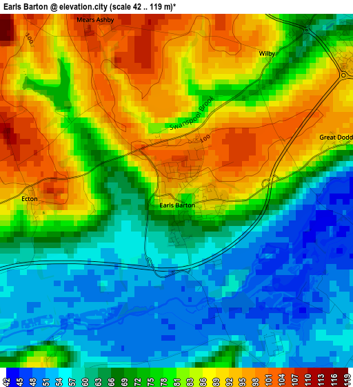
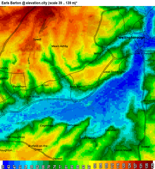
Below is the Elevation map of Earls Barton, which displays elevation range with different colors. Scale of the first map is from 42 to 119 m (138 to 390 ft) with average elevation of 74.3 meters (=244 ft) [note 1]
These maps also provides idea of topography and contour of this city, they are displayed at different zoom levels. More info about maps, scale and edge coordinates you can find below images.
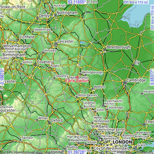
| \ | Map #1 | Map #2 | Topo.Map |
| Scale [m] | 42..119 m | 39..139 m | × |
| Scale [ft] | 138..390 ft | 128..456 ft | × |
| Average | 74.3 m = 244 ft | 82.4 m = 270 ft | × |
| Width | 5.98 km = 3.7 mi | 11.96 km = 7.4 mi | 191.4 km = 118.9 mi |
| Height | 5.98 km = 3.7 mi | 11.96 km = 7.4 mi | 191.4 km = 118.9 mi |
| ↑Max Latitude | 52.293156° | 52.320026° | 53.11855° |
| Latitude at center | 52.26627° | 52.26627° | 52.26627° |
| ↓Min Latitude | 52.239368° | 52.212449° | 51.39728° |
| ← Min Longitude | -0.796425° | -0.840371° | -2.15873° |
| Longitude center | -0.75248° | -0.75248° | -0.75248° |
| →Max Longitude | -0.708535° | -0.664589° | 0.65377° |
Nearby cities:
Cities around Earls Barton sort by population:
• Northampton elevation 97 m
9.1 km,  258°
258°
• Wellingborough 70 m
5.7 km,  44°
44°
• Rushden 61 m
10.6 km,  75°
75°
• Irchester 77 m
7.5 km, 77°
• Finedon 85 m
10.7 km, 40°
• Wollaston 87 m
5.7 km,  99°
99°
• Bozeat 84 m
7.2 km,  131°
131°
• Cogenhoe 82 m
3.8 km,  213°
213°
• Hackleton 94 m
9.9 km, 208°
• Sywell 112 m
4.7 km,  319°
319°
• Podington 75 m
8.8 km, 98°
• Warrington 81 m
10.1 km,  154°
154°
Multilingual:
 En español:
Earls Barton elevación 94 m.
 En France:
Earls Barton élévation 94 m.
 Auf Deutsch:
Earls Barton höhe über dem Meeresspiegel ist 94 m.

Sources and notes:
- [note 1] Map square and city borders are not equal. Map elevation data is calculated only from area inside that square.
- [src 1] Elevation data from geonames database provided with same terms of usage.
- [src 2] The elevation map of Earls Barton is generated using elevation data from NASA's 3 arcsec (90m) resolution SRTM data.
- [src 3] Base (background) map © OpenStreetMap contributors tiles are generated by Geofabrik and OpenTopoMap.
Copyright & License:
This Earls Barton Elevation Map is licensed under CC BY-SA. You may reuse any part from this page, if you give a proper credit by linking to this URL:
 More info on terms of use page.