Chester-le-Street elevation
Chester-le-Street (England, County Durham), United Kingdom elevation is 13 meters and Chester-le-Street elevation in feet is 43 ft above sea level [src 1]. Chester-le-Street is a populated place (feature code) with elevation that is 59 meters (194 ft) smaller than average city elevation in United Kingdom.
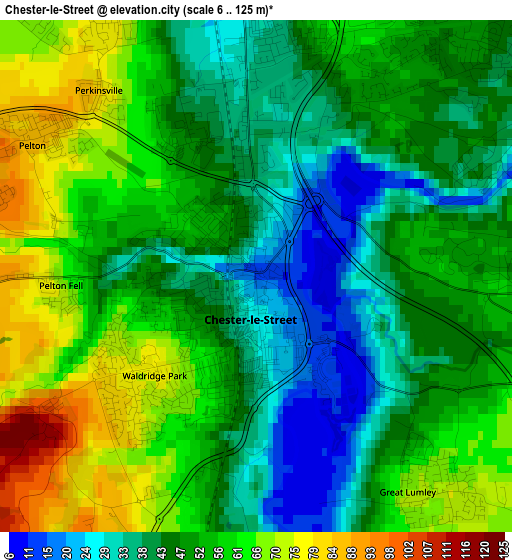
Below is the Elevation map of Chester-le-Street, which displays elevation range with different colors. Scale of the first map is from 6 to 125 m (20 to 410 ft) with average elevation of 51 meters (=167 ft) [note 1]
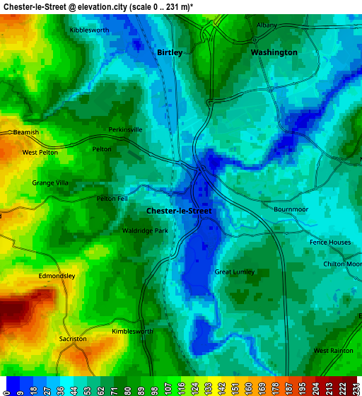
These maps also provides idea of topography and contour of this city, they are displayed at different zoom levels. More info about maps, scale and edge coordinates you can find below images.
| \ | Map #1 | Map #2 | Topo.Map |
| Scale [m] | 6..125 m | 0..231 m | × |
| Scale [ft] | 20..410 ft | 0..758 ft | × |
| Average | 51 m = 167 ft | 71.5 m = 235 ft | × |
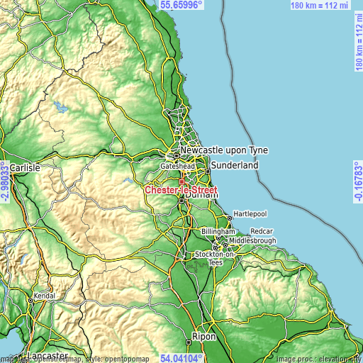
| Width | 5.62 km = 3.5 mi | 11.25 km = 7 mi | 180 km = 111.8 mi |
| Height | 5.63 km = 3.5 mi | 11.25 km = 7 mi | 180 km = 111.8 mi |
| ↑Max Latitude | 54.883907° | 54.909178° | 55.65996° |
| Latitude at center | 54.85862° | 54.85862° | 54.85862° |
| ↓Min Latitude | 54.833317° | 54.807999° | 54.04104° |
| ← Min Longitude | -1.618025° | -1.661971° | -2.98033° |
| Longitude center | -1.57408° | -1.57408° | -1.57408° |
| →Max Longitude | -1.530135° | -1.486189° | -0.16783° |
Nearby cities:
Cities around Chester-le-Street sort by population:
• Washington elevation 59 m
5.9 km,  38°
38°
• Durham 52 m
9.1 km,  180°
180°
• Houghton-Le-Spring 79 m
7.3 km,  106°
106°
• Stanley 225 m
8 km,  277°
277°
• Sacriston 154 m
5.6 km,  215°
215°
• Pelton 87 m
2.8 km,  305°
305°
• Langley Park 102 m
9 km, 223°
• Lamesley 12 m
6.7 km,  340°
340°
• Witton Gilbert 108 m
7.1 km,  214°
214°
• West Rainton 88 m
6.7 km,  134°
134°
• East Rainton 96 m
7.1 km,  121°
121°
• Pittington 129 m
8.7 km,  138°
138°
Multilingual:
 En español:
Chester-le-Street elevación 13 m.
 En France:
Chester-le-Street élévation 13 m.
 Auf Deutsch:
Chester-le-Street höhe über dem Meeresspiegel ist 13 m.

Sources and notes:
- [note 1] Map square and city borders are not equal. Map elevation data is calculated only from area inside that square.
- [src 1] Elevation data from geonames database provided with same terms of usage.
- [src 2] The elevation map of Chester-le-Street is generated using elevation data from NASA's 3 arcsec (90m) resolution SRTM data.
- [src 3] Base (background) map © OpenStreetMap contributors tiles are generated by Geofabrik and OpenTopoMap.
Copyright & License:
This Chester-le-Street Elevation Map is licensed under CC BY-SA. You may reuse any part from this page, if you give a proper credit by linking to this URL:
 More info on terms of use page.