Durham elevation
Durham (England, County Durham), United Kingdom elevation is 52 meters and Durham elevation in feet is 171 ft above sea level [src 1]. Durham is a seat of a second-order administrative division (feature code) with elevation that is 20 meters (66 ft) smaller than average city elevation in United Kingdom.
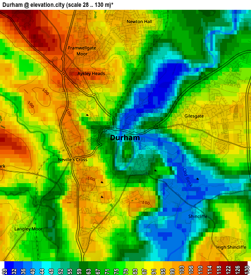
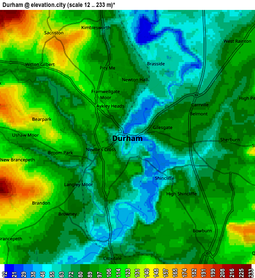
Below is the Elevation map of Durham, which displays elevation range with different colors. Scale of the first map is from 28 to 130 m (92 to 427 ft) with average elevation of 77 meters (=253 ft) [note 1]
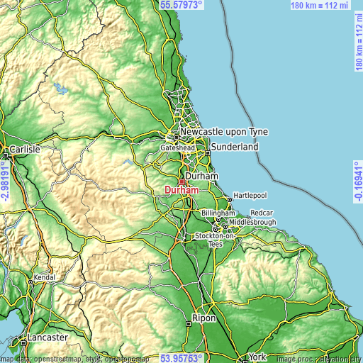
These maps also provides idea of topography and contour of this city, they are displayed at different zoom levels. More info about maps, scale and edge coordinates you can find below images.
| \ | Map #1 | Map #2 | Topo.Map |
| Scale [m] | 28..130 m | 12..233 m | × |
| Scale [ft] | 92..427 ft | 39..764 ft | × |
| Average | 77 m = 253 ft | 90.4 m = 297 ft | × |
| Width | 5.64 km = 3.5 mi | 11.27 km = 7 mi | 180.4 km = 112.1 mi |
| Height | 5.64 km = 3.5 mi | 11.27 km = 7 mi | 180.4 km = 112.1 mi |
| ↑Max Latitude | 54.802098° | 54.82742° | 55.57973° |
| Latitude at center | 54.77676° | 54.77676° | 54.77676° |
| ↓Min Latitude | 54.751406° | 54.726036° | 53.95753° |
| ← Min Longitude | -1.619605° | -1.663551° | -2.98191° |
| Longitude center | -1.57566° | -1.57566° | -1.57566° |
| →Max Longitude | -1.531715° | -1.487769° | -0.16941° |
Nearby cities:
Cities around Durham sort by population:
• Brandon elevation 87 m
4 km,  221°
221°
• Ushaw Moor 116 m
4.6 km,  271°
271°
• Sacriston 154 m
5.5 km,  325°
325°
• Langley Park 102 m
6.6 km,  292°
292°
• Bowburn 98 m
5.3 km,  142°
142°
• Coxhoe 108 m
8.3 km,  146°
146°
• Sherburn 88 m
4.5 km,  90°
90°
• Witton Gilbert 108 m
5.1 km,  309°
309°
• West Rainton 88 m
6.6 km,  47°
47°
• East Rainton 96 m
8.1 km, 48°
• Sherburn Hill 155 m
6.2 km, 94°
• Pittington 129 m
6.5 km,  66°
66°
Multilingual:
 En español:
Durham elevación 52 m.
 En France:
Durham élévation 52 m.


Sources and notes:
- [note 1] Map square and city borders are not equal. Map elevation data is calculated only from area inside that square.
- [src 1] Elevation data from geonames database provided with same terms of usage.
- [src 2] The elevation map of Durham is generated using elevation data from NASA's 3 arcsec (90m) resolution SRTM data.
- [src 3] Base (background) map © OpenStreetMap contributors tiles are generated by Geofabrik and OpenTopoMap.
Copyright & License:
This Durham Elevation Map is licensed under CC BY-SA. You may reuse any part from this page, if you give a proper credit by linking to this URL:
 More info on terms of use page.