Clayton elevation
Clayton (England, Bradford), United Kingdom elevation is 291 meters and Clayton elevation in feet is 955 ft above sea level [src 1]. Clayton is a seat of a third-order administrative division (feature code) with elevation that is 219 meters (719 ft) bigger than average city elevation in United Kingdom.
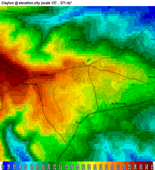
Below is the Elevation map of Clayton, which displays elevation range with different colors. Scale of the first map is from 137 to 371 m (449 to 1217 ft) with average elevation of 243.6 meters (=799 ft) [note 1]
These maps also provides idea of topography and contour of this city, they are displayed at different zoom levels. More info about maps, scale and edge coordinates you can find below images.
| \ | Map #1 | Topo.Map |
| Scale [m] | 137..371 m | × |
| Scale [ft] | 449..1217 ft | × |
| Average | 243.6 m = 799 ft | × |
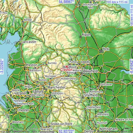
| Width | 5.78 km = 3.6 mi | 184.8 km = 114.8 mi |
| Height | 5.78 km = 3.6 mi | 184.8 km = 114.8 mi |
| ↑Max Latitude | 53.792637° | 54.58967° |
| Latitude at center | 53.76667° | 53.76667° |
| ↓Min Latitude | 53.740687° | 52.92722° |
| ← Min Longitude | -1.860615° | -3.22292° |
| Longitude center | -1.81667° | -1.81667° |
| →Max Longitude | -1.772725° | -0.41042° |
Nearby cities:
Cities around Clayton sort by population:
• Bradford elevation 110 m
5.2 km,  54°
54°
• Halifax 150 m
6 km,  201°
201°
• Brighouse 80 m
7.4 km,  163°
163°
• Shipley 93 m
8.1 km,  23°
23°
• Cleckheaton 92 m
8.3 km,  124°
124°
• Rastrick 73 m
8.5 km,  167°
167°
• Sowerby Bridge 86 m
8.8 km,  223°
223°
• Queensbury 308 m
2.1 km,  269°
269°
• Wilsden 216 m
6.7 km,  334°
334°
• Denholme 289 m
6.5 km,  307°
307°
• Cullingworth 205 m
8.3 km,  320°
320°
• Southowram 227 m
6.4 km,  188°
188°
Multilingual:
 En español:
Clayton elevación 291 m.
 En France:
Clayton élévation 291 m.


Sources and notes:
- [note 1] Map square and city borders are not equal. Map elevation data is calculated only from area inside that square.
- [src 1] Elevation data from geonames database provided with same terms of usage.
- [src 2] The elevation map of Clayton is generated using elevation data from NASA's 3 arcsec (90m) resolution SRTM data.
- [src 3] Base (background) map © OpenStreetMap contributors tiles are generated by Geofabrik and OpenTopoMap.
Copyright & License:
This Clayton Elevation Map is licensed under CC BY-SA. You may reuse any part from this page, if you give a proper credit by linking to this URL:
 More info on terms of use page.