Southowram elevation
Southowram (England, Calderdale), United Kingdom elevation is 227 meters and Southowram elevation in feet is 745 ft above sea level [src 1]. Southowram is a populated place (feature code) with elevation that is 155 meters (509 ft) bigger than average city elevation in United Kingdom.
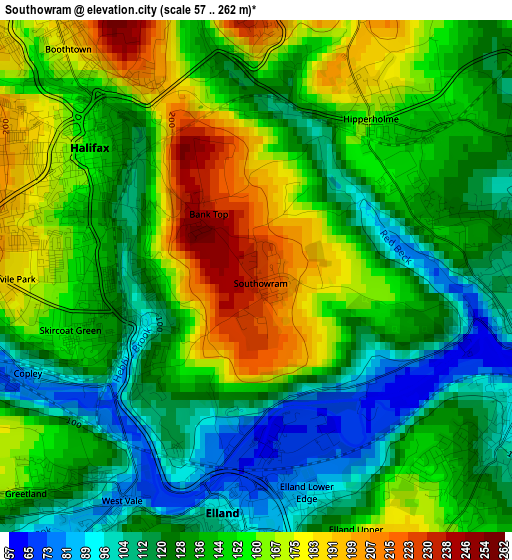
Below is the Elevation map of Southowram, which displays elevation range with different colors. Scale of the first map is from 57 to 262 m (187 to 860 ft) with average elevation of 142.5 meters (=468 ft) [note 1]
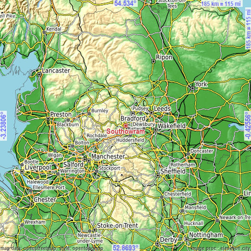
These maps also provides idea of topography and contour of this city, they are displayed at different zoom levels. More info about maps, scale and edge coordinates you can find below images.
| \ | Map #1 | Topo.Map |
| Scale [m] | 57..262 m | × |
| Scale [ft] | 187..860 ft | × |
| Average | 142.5 m = 468 ft | × |
| Width | 5.78 km = 3.6 mi | 185.1 km = 115 mi |
| Height | 5.78 km = 3.6 mi | 185.1 km = 115 mi |
| ↑Max Latitude | 53.735882° | 54.534° |
| Latitude at center | 53.70988° | 53.70988° |
| ↓Min Latitude | 53.683862° | 52.8693° |
| ← Min Longitude | -1.875755° | -3.23806° |
| Longitude center | -1.83181° | -1.83181° |
| →Max Longitude | -1.787865° | -0.42556° |
Nearby cities:
Cities around Southowram sort by population:
• Huddersfield elevation 90 m
7.5 km,  155°
155°
• Halifax 150 m
1.4 km,  302°
302°
• Brighouse 80 m
3.2 km,  103°
103°
• Cleckheaton 92 m
8 km,  78°
78°
• Elland 105 m
2.8 km,  189°
189°
• Rastrick 73 m
3.5 km,  124°
124°
• Sowerby Bridge 86 m
5.1 km,  268°
268°
• Queensbury 308 m
6.4 km,  349°
349°
• Holywell Green 147 m
4.6 km,  210°
210°
• Luddenden Foot 114 m
7.6 km,  277°
277°
• Barkisland 230 m
6.8 km,  236°
236°
• Clayton 291 m
6.4 km,  8°
8°
Multilingual:
 En español:
Southowram elevación 227 m.
 En France:
Southowram élévation 227 m.
 Auf Deutsch:
Southowram höhe über dem Meeresspiegel ist 227 m.

Sources and notes:
- [note 1] Map square and city borders are not equal. Map elevation data is calculated only from area inside that square.
- [src 1] Elevation data from geonames database provided with same terms of usage.
- [src 2] The elevation map of Southowram is generated using elevation data from NASA's 3 arcsec (90m) resolution SRTM data.
- [src 3] Base (background) map © OpenStreetMap contributors tiles are generated by Geofabrik and OpenTopoMap.
Copyright & License:
This Southowram Elevation Map is licensed under CC BY-SA. You may reuse any part from this page, if you give a proper credit by linking to this URL:
 More info on terms of use page.