Shipley elevation
Shipley (England, Bradford), United Kingdom elevation is 93 meters and Shipley elevation in feet is 305 ft above sea level [src 1]. Shipley is a populated place (feature code) with elevation that is 21 meters (69 ft) bigger than average city elevation in United Kingdom.
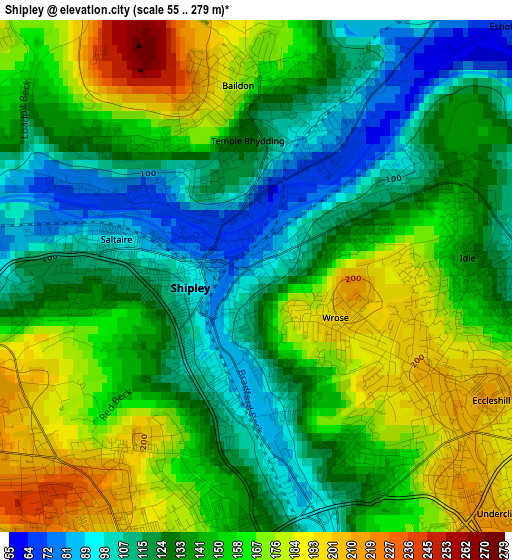
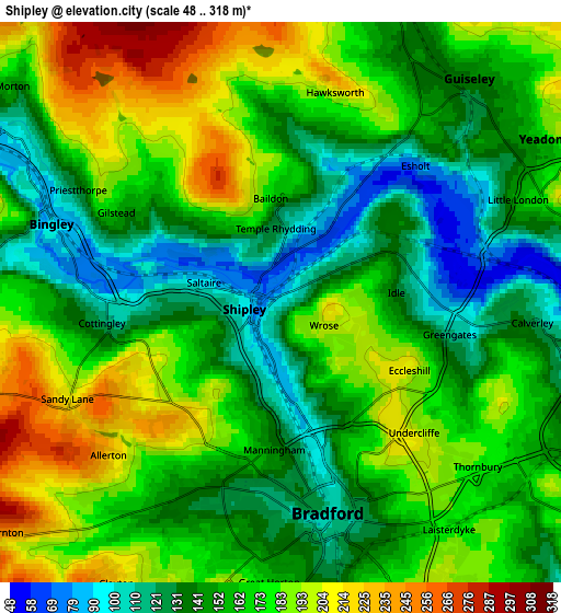
Below is the Elevation map of Shipley, which displays elevation range with different colors. Scale of the first map is from 55 to 279 m (180 to 915 ft) with average elevation of 143.6 meters (=471 ft) [note 1]
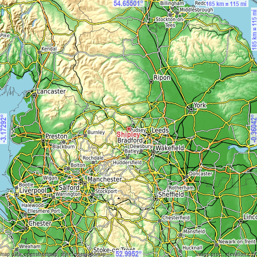
These maps also provides idea of topography and contour of this city, they are displayed at different zoom levels. More info about maps, scale and edge coordinates you can find below images.
| \ | Map #1 | Map #2 | Topo.Map |
| Scale [m] | 55..279 m | 48..318 m | × |
| Scale [ft] | 180..915 ft | 157..1043 ft | × |
| Average | 143.6 m = 471 ft | 162.3 m = 532 ft | × |
| Width | 5.77 km = 3.6 mi | 11.53 km = 7.2 mi | 184.6 km = 114.7 mi |
| Height | 5.77 km = 3.6 mi | 11.53 km = 7.2 mi | 184.5 km = 114.6 mi |
| ↑Max Latitude | 53.859256° | 53.885165° | 54.65501° |
| Latitude at center | 53.83333° | 53.83333° | 53.83333° |
| ↓Min Latitude | 53.807388° | 53.78143° | 52.9952° |
| ← Min Longitude | -1.810615° | -1.854561° | -3.17292° |
| Longitude center | -1.76667° | -1.76667° | -1.76667° |
| →Max Longitude | -1.722725° | -1.678779° | -0.36042° |
Nearby cities:
Cities around Shipley sort by population:
• Bradford elevation 110 m
4.5 km,  167°
167°
• Yeadon 165 m
6.2 km,  56°
56°
• Pudsey 163 m
8.1 km,  121°
121°
• Guiseley 140 m
5.9 km,  37°
37°
• Bingley 91 m
5 km,  289°
289°
• Horsforth 145 m
8.5 km,  83°
83°
• Baildon 155 m
2.1 km,  317°
317°
• Burley in Wharfedale 109 m
8.6 km,  3°
3°
• Wilsden 216 m
6.3 km,  257°
257°
• Menston 144 m
6.5 km,  13°
13°
• Cullingworth 205 m
8.6 km, 263°
• Clayton 291 m
8.1 km,  203°
203°
Multilingual:
 En español:
Shipley elevación 93 m.
 En France:
Shipley élévation 93 m.


Sources and notes:
- [note 1] Map square and city borders are not equal. Map elevation data is calculated only from area inside that square.
- [src 1] Elevation data from geonames database provided with same terms of usage.
- [src 2] The elevation map of Shipley is generated using elevation data from NASA's 3 arcsec (90m) resolution SRTM data.
- [src 3] Base (background) map © OpenStreetMap contributors tiles are generated by Geofabrik and OpenTopoMap.
Copyright & License:
This Shipley Elevation Map is licensed under CC BY-SA. You may reuse any part from this page, if you give a proper credit by linking to this URL:
 More info on terms of use page.