Coalville elevation
Coalville (England, Leicestershire), United Kingdom elevation is 161 meters and Coalville elevation in feet is 528 ft above sea level [src 1]. Coalville is a populated place (feature code) with elevation that is 89 meters (292 ft) bigger than average city elevation in United Kingdom.
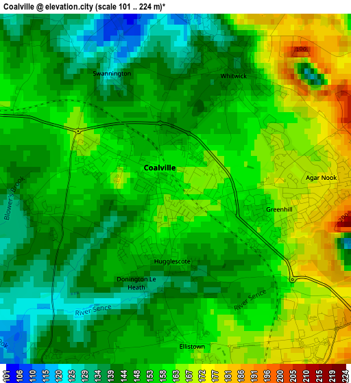
Below is the Elevation map of Coalville, which displays elevation range with different colors. Scale of the first map is from 101 to 224 m (331 to 735 ft) with average elevation of 153.3 meters (=503 ft) [note 1]
These maps also provides idea of topography and contour of this city, they are displayed at different zoom levels. More info about maps, scale and edge coordinates you can find below images.
| \ | Map #1 | Map #2 | Topo.Map |
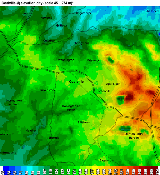
| Scale [m] | 101..224 m | 45..274 m | × |
| Scale [ft] | 331..735 ft | 148..899 ft | × |
| Average | 153.3 m = 503 ft | 144.1 m = 473 ft | × |
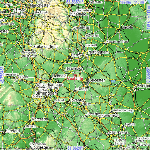
| Width | 5.92 km = 3.7 mi | 11.84 km = 7.4 mi | 189.4 km = 117.7 mi |
| Height | 5.92 km = 3.7 mi | 11.84 km = 7.4 mi | 189.4 km = 117.7 mi |
| ↑Max Latitude | 52.749079° | 52.775671° | 53.56591° |
| Latitude at center | 52.72247° | 52.72247° | 52.72247° |
| ↓Min Latitude | 52.695845° | 52.669204° | 51.8624° |
| ← Min Longitude | -1.414145° | -1.458091° | -2.77645° |
| Longitude center | -1.3702° | -1.3702° | -1.3702° |
| →Max Longitude | -1.326255° | -1.282309° | 0.03605° |
Nearby cities:
Cities around Coalville sort by population:
• Shepshed elevation 81 m
7.2 km,  48°
48°
• Ashby de la Zouch 126 m
7.4 km,  290°
290°
• Ibstock 134 m
4.6 km,  205°
205°
• Measham 105 m
9.3 km,  259°
259°
• Markfield 179 m
7.5 km,  121°
121°
• Newbold Verdon 136 m
10.5 km,  169°
169°
• Barlestone 132 m
8.4 km,  179°
179°
• Market Bosworth 134 m
11.1 km,  191°
191°
• Hathern 47 m
11.2 km,  43°
43°
• Ravenstone 149 m
2.4 km,  266°
266°
• Bagworth 162 m
5.8 km,  161°
161°
• Long Whatton 50 m
10.9 km,  31°
31°
Multilingual:
 En español:
Coalville elevación 161 m.
 En France:
Coalville élévation 161 m.
 Auf Deutsch:
Coalville höhe über dem Meeresspiegel ist 161 m.

Sources and notes:
- [note 1] Map square and city borders are not equal. Map elevation data is calculated only from area inside that square.
- [src 1] Elevation data from geonames database provided with same terms of usage.
- [src 2] The elevation map of Coalville is generated using elevation data from NASA's 3 arcsec (90m) resolution SRTM data.
- [src 3] Base (background) map © OpenStreetMap contributors tiles are generated by Geofabrik and OpenTopoMap.
Copyright & License:
This Coalville Elevation Map is licensed under CC BY-SA. You may reuse any part from this page, if you give a proper credit by linking to this URL:
 More info on terms of use page.