Shepshed elevation
Shepshed (England, Leicestershire), United Kingdom elevation is 81 meters and Shepshed elevation in feet is 266 ft above sea level [src 1]. Shepshed is a populated place (feature code) with elevation that is 9 meters (30 ft) bigger than average city elevation in United Kingdom.
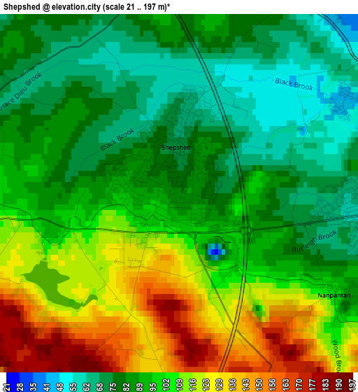
Below is the Elevation map of Shepshed, which displays elevation range with different colors. Scale of the first map is from 21 to 197 m (69 to 646 ft) with average elevation of 96.3 meters (=316 ft) [note 1]
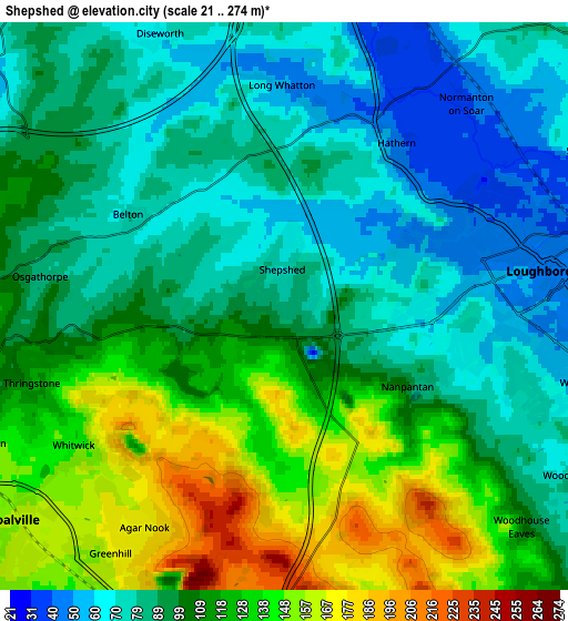
These maps also provides idea of topography and contour of this city, they are displayed at different zoom levels. More info about maps, scale and edge coordinates you can find below images.
| \ | Map #1 | Map #2 | Topo.Map |
| Scale [m] | 21..197 m | 21..274 m | × |
| Scale [ft] | 69..646 ft | 69..899 ft | × |
| Average | 96.3 m = 316 ft | 103.5 m = 340 ft | × |
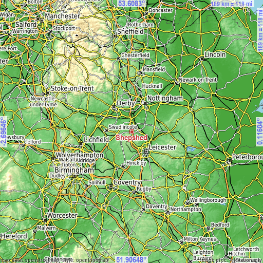
| Width | 5.91 km = 3.7 mi | 11.83 km = 7.4 mi | 189.2 km = 117.6 mi |
| Height | 5.91 km = 3.7 mi | 11.83 km = 7.4 mi | 189.2 km = 117.6 mi |
| ↑Max Latitude | 52.792282° | 52.818848° | 53.6083° |
| Latitude at center | 52.7657° | 52.7657° | 52.7657° |
| ↓Min Latitude | 52.739102° | 52.712487° | 51.90648° |
| ← Min Longitude | -1.334155° | -1.378101° | -2.69646° |
| Longitude center | -1.29021° | -1.29021° | -1.29021° |
| →Max Longitude | -1.246265° | -1.202319° | 0.11604° |
Nearby cities:
Cities around Shepshed sort by population:
• Loughborough elevation 49 m
6.1 km,  88°
88°
• Coalville 161 m
7.2 km,  228°
228°
• Castle Donington 69 m
9.3 km,  337°
337°
• East Leake 52 m
10.3 km,  45°
45°
• Barrow upon Soar 61 m
9.8 km,  99°
99°
• Quorndon 51 m
8.2 km,  106°
106°
• Markfield 179 m
8.8 km,  173°
173°
• Kegworth 49 m
7.7 km,  4°
4°
• Hathern 47 m
4 km,  34°
34°
• Ravenstone 149 m
9.2 km,  237°
237°
• Sutton Bonington 48 m
6.8 km,  23°
23°
• Long Whatton 50 m
4.5 km, 4°
Multilingual:
 En español:
Shepshed elevación 81 m.
 En France:
Shepshed élévation 81 m.


Sources and notes:
- [note 1] Map square and city borders are not equal. Map elevation data is calculated only from area inside that square.
- [src 1] Elevation data from geonames database provided with same terms of usage.
- [src 2] The elevation map of Shepshed is generated using elevation data from NASA's 3 arcsec (90m) resolution SRTM data.
- [src 3] Base (background) map © OpenStreetMap contributors tiles are generated by Geofabrik and OpenTopoMap.
Copyright & License:
This Shepshed Elevation Map is licensed under CC BY-SA. You may reuse any part from this page, if you give a proper credit by linking to this URL:
 More info on terms of use page.