Sutton Bonington elevation
Sutton Bonington (England, Nottinghamshire), United Kingdom elevation is 48 meters and Sutton Bonington elevation in feet is 157 ft above sea level [src 1]. Sutton Bonington is a populated place (feature code) with elevation that is 24 meters (79 ft) smaller than average city elevation in United Kingdom.
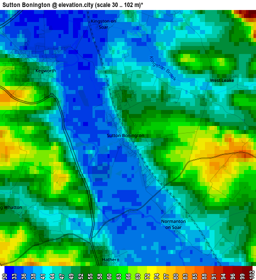
Below is the Elevation map of Sutton Bonington, which displays elevation range with different colors. Scale of the first map is from 30 to 102 m (98 to 335 ft) with average elevation of 49.1 meters (=161 ft) [note 1]
These maps also provides idea of topography and contour of this city, they are displayed at different zoom levels. More info about maps, scale and edge coordinates you can find below images.
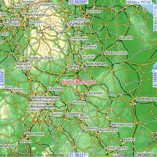
| \ | Map #1 | Topo.Map |
| Scale [m] | 30..102 m | × |
| Scale [ft] | 98..335 ft | × |
| Average | 49.1 m = 161 ft | × |
| Width | 5.91 km = 3.7 mi | 189 km = 117.4 mi |
| Height | 5.91 km = 3.7 mi | 189 km = 117.4 mi |
| ↑Max Latitude | 52.847988° | 53.66295° |
| Latitude at center | 52.82144° | 52.82144° |
| ↓Min Latitude | 52.794876° | 51.96331° |
| ← Min Longitude | -1.293635° | -2.65594° |
| Longitude center | -1.24969° | -1.24969° |
| →Max Longitude | -1.205745° | 0.15656° |
Nearby cities:
Cities around Sutton Bonington sort by population:
• Loughborough elevation 49 m
6.9 km,  151°
151°
• Long Eaton 34 m
8.7 km,  350°
350°
• Shepshed 81 m
6.8 km,  203°
203°
• Castle Donington 69 m
6.6 km,  291°
291°
• East Leake 52 m
4.7 km,  78°
78°
• Quorndon 51 m
10 km, 149°
• Kegworth 49 m
2.5 km,  305°
305°
• Hathern 47 m
2.9 km,  188°
188°
• Gotham 36 m
6 km,  29°
29°
• Wymeswold 76 m
9.4 km,  101°
101°
• Burton on the Wolds 71 m
9 km,  116°
116°
• Long Whatton 50 m
2.9 km,  233°
233°
Multilingual:
 En español:
Sutton Bonington elevación 48 m.
 En France:
Sutton Bonington élévation 48 m.
 Auf Deutsch:
Sutton Bonington höhe über dem Meeresspiegel ist 48 m.

Sources and notes:
- [note 1] Map square and city borders are not equal. Map elevation data is calculated only from area inside that square.
- [src 1] Elevation data from geonames database provided with same terms of usage.
- [src 2] The elevation map of Sutton Bonington is generated using elevation data from NASA's 3 arcsec (90m) resolution SRTM data.
- [src 3] Base (background) map © OpenStreetMap contributors tiles are generated by Geofabrik and OpenTopoMap.
Copyright & License:
This Sutton Bonington Elevation Map is licensed under CC BY-SA. You may reuse any part from this page, if you give a proper credit by linking to this URL:
 More info on terms of use page.