Long Eaton elevation
Long Eaton (England, Derbyshire), United Kingdom elevation is 34 meters and Long Eaton elevation in feet is 112 ft above sea level [src 1]. Long Eaton is a populated place (feature code) with elevation that is 38 meters (125 ft) smaller than average city elevation in United Kingdom.
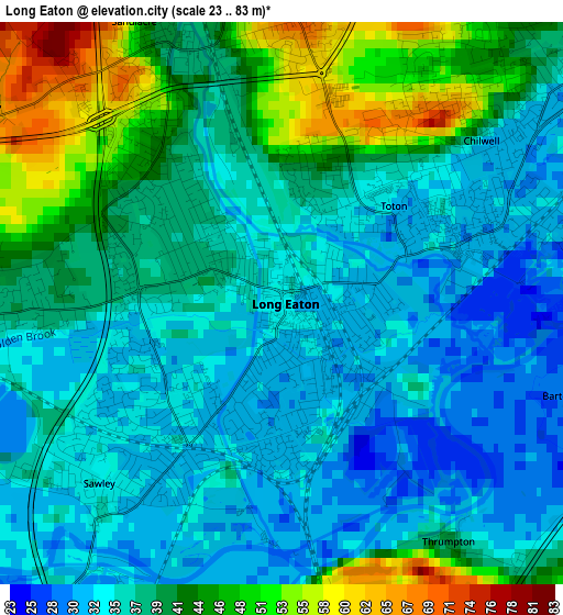
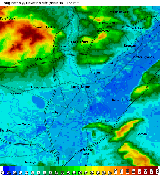
Below is the Elevation map of Long Eaton, which displays elevation range with different colors. Scale of the first map is from 23 to 83 m (75 to 272 ft) with average elevation of 38.4 meters (=126 ft) [note 1]
These maps also provides idea of topography and contour of this city, they are displayed at different zoom levels. More info about maps, scale and edge coordinates you can find below images.
| \ | Map #1 | Map #2 | Topo.Map |
| Scale [m] | 23..83 m | 16..133 m | × |
| Scale [ft] | 75..272 ft | 52..436 ft | × |
| Average | 38.4 m = 126 ft | 47.1 m = 155 ft | × |
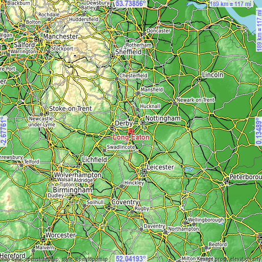
| Width | 5.9 km = 3.7 mi | 11.79 km = 7.3 mi | 188.6 km = 117.2 mi |
| Height | 5.9 km = 3.7 mi | 11.79 km = 7.3 mi | 188.6 km = 117.2 mi |
| ↑Max Latitude | 52.925051° | 52.951536° | 53.73856° |
| Latitude at center | 52.89855° | 52.89855° | 52.89855° |
| ↓Min Latitude | 52.872033° | 52.845499° | 52.04193° |
| ← Min Longitude | -1.315305° | -1.359251° | -2.67761° |
| Longitude center | -1.27136° | -1.27136° | -1.27136° |
| →Max Longitude | -1.227415° | -1.183469° | 0.13489° |
Nearby cities:
Cities around Long Eaton sort by population:
• Ilkeston elevation 103 m
8.4 km,  342°
342°
• Basford 35 m
9.6 km,  37°
37°
• Kimberley 93 m
9.4 km,  1°
1°
• Castle Donington 69 m
7.8 km,  217°
217°
• Ruddington 41 m
8.2 km,  94°
94°
• East Leake 52 m
9.7 km,  141°
141°
• West Hallam 86 m
9.9 km,  324°
324°
• Borrowash 52 m
7.6 km,  276°
276°
• Kegworth 49 m
7.1 km,  184°
184°
• Aston-on-Trent 43 m
8.7 km,  242°
242°
• Gotham 36 m
5.6 km,  127°
127°
• Sutton Bonington 48 m
8.7 km,  170°
170°
Multilingual:
 En español:
Long Eaton elevación 34 m.
 En France:
Long Eaton élévation 34 m.
 Auf Deutsch:
Long Eaton höhe über dem Meeresspiegel ist 34 m.

Sources and notes:
- [note 1] Map square and city borders are not equal. Map elevation data is calculated only from area inside that square.
- [src 1] Elevation data from geonames database provided with same terms of usage.
- [src 2] The elevation map of Long Eaton is generated using elevation data from NASA's 3 arcsec (90m) resolution SRTM data.
- [src 3] Base (background) map © OpenStreetMap contributors tiles are generated by Geofabrik and OpenTopoMap.
Copyright & License:
This Long Eaton Elevation Map is licensed under CC BY-SA. You may reuse any part from this page, if you give a proper credit by linking to this URL:
 More info on terms of use page.