Cowbridge elevation
Cowbridge (Wales, Vale of Glamorgan), United Kingdom elevation is 35 meters and Cowbridge elevation in feet is 115 ft above sea level [src 1]. Cowbridge is a populated place (feature code) with elevation that is 37 meters (121 ft) smaller than average city elevation in United Kingdom.
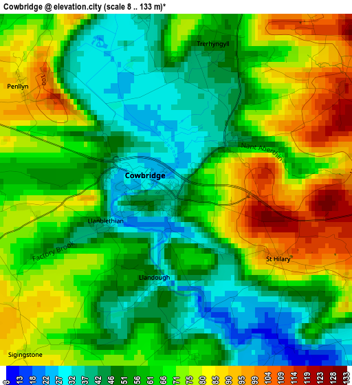
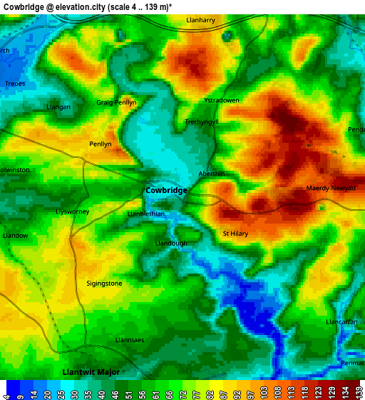
Below is the Elevation map of Cowbridge, which displays elevation range with different colors. Scale of the first map is from 8 to 133 m (26 to 436 ft) with average elevation of 62.6 meters (=205 ft) [note 1]
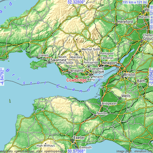
These maps also provides idea of topography and contour of this city, they are displayed at different zoom levels. More info about maps, scale and edge coordinates you can find below images.
| \ | Map #1 | Map #2 | Topo.Map |
| Scale [m] | 8..133 m | 4..139 m | × |
| Scale [ft] | 26..436 ft | 13..456 ft | × |
| Average | 62.6 m = 205 ft | 64.9 m = 213 ft | × |
| Width | 6.09 km = 3.8 mi | 12.18 km = 7.6 mi | 194.8 km = 121 mi |
| Height | 6.09 km = 3.8 mi | 12.18 km = 7.6 mi | 194.8 km = 121 mi |
| ↑Max Latitude | 51.487652° | 51.515008° | 52.32806° |
| Latitude at center | 51.46028° | 51.46028° | 51.46028° |
| ↓Min Latitude | 51.432891° | 51.405486° | 50.57568° |
| ← Min Longitude | -3.485615° | -3.529561° | -4.84792° |
| Longitude center | -3.44167° | -3.44167° | -3.44167° |
| →Max Longitude | -3.397725° | -3.353779° | -2.03542° |
Nearby cities:
Cities around Cowbridge sort by population:
• Coity elevation 64 m
10.4 km,  311°
311°
• Llantrisant 101 m
10.1 km,  27°
27°
• Llantwit Major 48 m
6.3 km,  209°
209°
• Pencoed 33 m
8.1 km,  330°
330°
• Brynna 80 m
8.8 km,  350°
350°
• Rhoose 46 m
10 km,  142°
142°
• Pontyclun 49 m
7.7 km, 27°
• Llanharan 76 m
8.6 km,  1°
1°
• Llanharry 90 m
6 km,  6°
6°
• Wick 99 m
7.8 km,  252°
252°
• Llangan 42 m
5 km, 306°
• Penllyn 95 m
3 km,  301°
301°
Multilingual:
 En español:
Cowbridge elevación 35 m.
 En France:
Cowbridge élévation 35 m.
 Auf Deutsch:
Cowbridge höhe über dem Meeresspiegel ist 35 m.

Sources and notes:
- [note 1] Map square and city borders are not equal. Map elevation data is calculated only from area inside that square.
- [src 1] Elevation data from geonames database provided with same terms of usage.
- [src 2] The elevation map of Cowbridge is generated using elevation data from NASA's 3 arcsec (90m) resolution SRTM data.
- [src 3] Base (background) map © OpenStreetMap contributors tiles are generated by Geofabrik and OpenTopoMap.
Copyright & License:
This Cowbridge Elevation Map is licensed under CC BY-SA. You may reuse any part from this page, if you give a proper credit by linking to this URL:
 More info on terms of use page.