Coity elevation
Coity (Wales, Bridgend county borough), United Kingdom elevation is 64 meters and Coity elevation in feet is 210 ft above sea level [src 1]. Coity is a populated place (feature code) with elevation that is 8 meters (26 ft) smaller than average city elevation in United Kingdom.
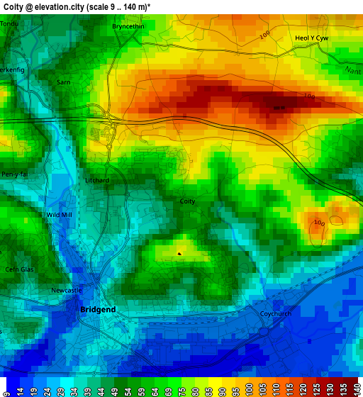
Below is the Elevation map of Coity, which displays elevation range with different colors. Scale of the first map is from 9 to 140 m (30 to 459 ft) with average elevation of 58.3 meters (=191 ft) [note 1]
These maps also provides idea of topography and contour of this city, they are displayed at different zoom levels. More info about maps, scale and edge coordinates you can find below images.
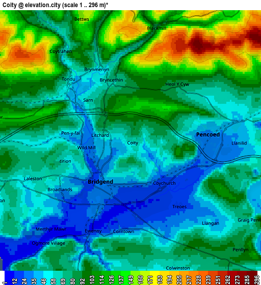
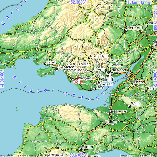
| \ | Map #1 | Map #2 | Topo.Map |
| Scale [m] | 9..140 m | 1..296 m | × |
| Scale [ft] | 30..459 ft | 3..971 ft | × |
| Average | 58.3 m = 191 ft | 83.9 m = 275 ft | × |
| Width | 6.08 km = 3.8 mi | 12.16 km = 7.6 mi | 194.6 km = 120.9 mi |
| Height | 6.08 km = 3.8 mi | 12.16 km = 7.6 mi | 194.6 km = 120.9 mi |
| ↑Max Latitude | 51.549335° | 51.576654° | 52.3886° |
| Latitude at center | 51.522° | 51.522° | 51.522° |
| ↓Min Latitude | 51.494648° | 51.46728° | 50.63859° |
| ← Min Longitude | -3.599255° | -3.643201° | -4.96156° |
| Longitude center | -3.55531° | -3.55531° | -3.55531° |
| →Max Longitude | -3.511365° | -3.467419° | -2.14906° |
Nearby cities:
Cities around Coity sort by population:
• Bridgend elevation 23 m
2.4 km,  220°
220°
• Aberkenfig 39 m
3.4 km,  305°
305°
• Pencoed 33 m
3.8 km,  87°
87°
• Brynna 80 m
6.6 km,  73°
73°
• Llanharan 76 m
8.2 km,  77°
77°
• Llanharry 90 m
8.5 km,  95°
95°
• Ogmore Vale 148 m
9 km,  5°
5°
• Betws 136 m
5.7 km,  336°
336°
• Cefn Cribwr 128 m
6.8 km,  279°
279°
• Penllyn 95 m
7.5 km,  134°
134°
• Merthyr Mawr 12 m
5.4 km, 222°
• Llangan 42 m
5.4 km,  135°
135°
Multilingual:
 En español:
Coity elevación 64 m.
 En France:
Coity élévation 64 m.


Sources and notes:
- [note 1] Map square and city borders are not equal. Map elevation data is calculated only from area inside that square.
- [src 1] Elevation data from geonames database provided with same terms of usage.
- [src 2] The elevation map of Coity is generated using elevation data from NASA's 3 arcsec (90m) resolution SRTM data.
- [src 3] Base (background) map © OpenStreetMap contributors tiles are generated by Geofabrik and OpenTopoMap.
Copyright & License:
This Coity Elevation Map is licensed under CC BY-SA. You may reuse any part from this page, if you give a proper credit by linking to this URL:
 More info on terms of use page.