Crook elevation
Crook (England, County Durham), United Kingdom elevation is 152 meters and Crook elevation in feet is 499 ft above sea level [src 1]. Crook is a populated place (feature code) with elevation that is 80 meters (262 ft) bigger than average city elevation in United Kingdom.
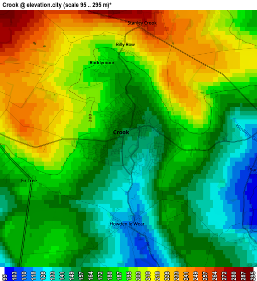
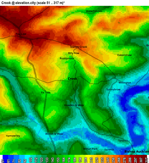
Below is the Elevation map of Crook, which displays elevation range with different colors. Scale of the first map is from 95 to 295 m (312 to 968 ft) with average elevation of 183.4 meters (=602 ft) [note 1]
These maps also provides idea of topography and contour of this city, they are displayed at different zoom levels. More info about maps, scale and edge coordinates you can find below images.
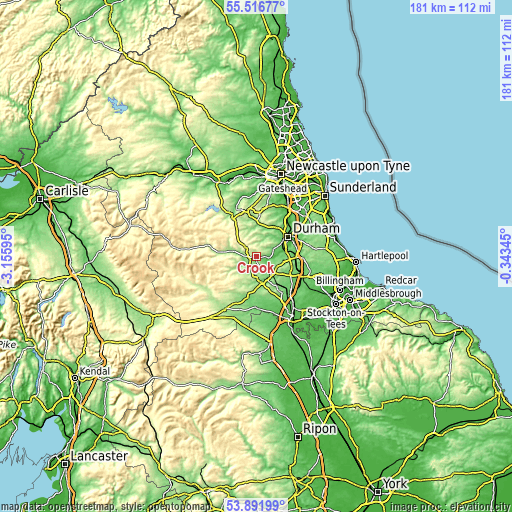
| \ | Map #1 | Map #2 | Topo.Map |
| Scale [m] | 95..295 m | 51..317 m | × |
| Scale [ft] | 312..968 ft | 167..1040 ft | × |
| Average | 183.4 m = 602 ft | 173.2 m = 568 ft | × |
| Width | 5.65 km = 3.5 mi | 11.29 km = 7 mi | 180.7 km = 112.3 mi |
| Height | 5.65 km = 3.5 mi | 11.29 km = 7 mi | 180.6 km = 112.2 mi |
| ↑Max Latitude | 54.737898° | 54.763261° | 55.51677° |
| Latitude at center | 54.71252° | 54.71252° | 54.71252° |
| ↓Min Latitude | 54.687126° | 54.661716° | 53.89199° |
| ← Min Longitude | -1.793645° | -1.837591° | -3.15595° |
| Longitude center | -1.7497° | -1.7497° | -1.7497° |
| →Max Longitude | -1.705755° | -1.661809° | -0.34345° |
Nearby cities:
Cities around Crook sort by population:
• Bishop Auckland elevation 110 m
7.9 km,  143°
143°
• Spennymoor 111 m
9.6 km,  99°
99°
• Brandon 87 m
9.5 km,  63°
63°
• Ushaw Moor 116 m
9.8 km,  42°
42°
• Willington 140 m
3.2 km,  81°
81°
• Coundon 175 m
9.6 km,  125°
125°
• Wolsingham 142 m
8.8 km,  283°
283°
• Tow Law 306 m
5.5 km,  310°
310°
• High Etherley 164 m
6.5 km,  176°
176°
• Low Etherley 167 m
6.6 km, 176°
• Hunwick 128 m
3.9 km, 133°
• Hamsterley 121 m
5.4 km,  232°
232°
Multilingual:
 En español:
Crook elevación 152 m.
 En France:
Crook élévation 152 m.


Sources and notes:
- [note 1] Map square and city borders are not equal. Map elevation data is calculated only from area inside that square.
- [src 1] Elevation data from geonames database provided with same terms of usage.
- [src 2] The elevation map of Crook is generated using elevation data from NASA's 3 arcsec (90m) resolution SRTM data.
- [src 3] Base (background) map © OpenStreetMap contributors tiles are generated by Geofabrik and OpenTopoMap.
Copyright & License:
This Crook Elevation Map is licensed under CC BY-SA. You may reuse any part from this page, if you give a proper credit by linking to this URL:
 More info on terms of use page.