Didcot elevation
Didcot (England, Oxfordshire), United Kingdom elevation is 58 meters and Didcot elevation in feet is 190 ft above sea level [src 1]. Didcot is a populated place (feature code) with elevation that is 14 meters (46 ft) smaller than average city elevation in United Kingdom.
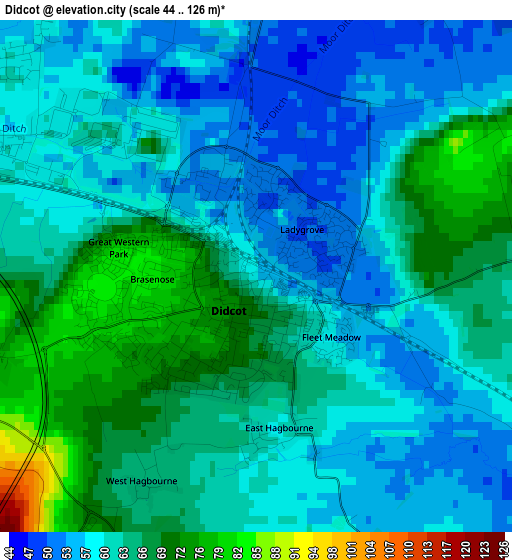
Below is the Elevation map of Didcot, which displays elevation range with different colors. Scale of the first map is from 44 to 126 m (144 to 413 ft) with average elevation of 62 meters (=203 ft) [note 1]
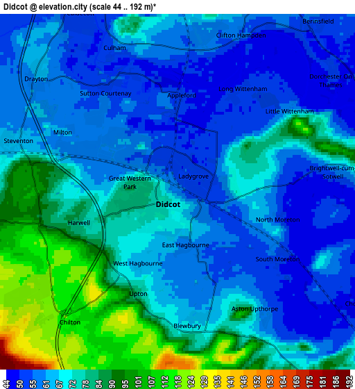
These maps also provides idea of topography and contour of this city, they are displayed at different zoom levels. More info about maps, scale and edge coordinates you can find below images.
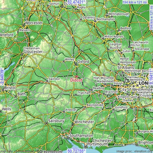
| \ | Map #1 | Map #2 | Topo.Map |
| Scale [m] | 44..126 m | 44..192 m | × |
| Scale [ft] | 144..413 ft | 144..630 ft | × |
| Average | 62 m = 203 ft | 70.2 m = 230 ft | × |
| Width | 6.07 km = 3.8 mi | 12.14 km = 7.5 mi | 194.2 km = 120.7 mi |
| Height | 6.07 km = 3.8 mi | 12.14 km = 7.5 mi | 194.2 km = 120.7 mi |
| ↑Max Latitude | 51.636563° | 51.663829° | 52.47421° |
| Latitude at center | 51.60928° | 51.60928° | 51.60928° |
| ↓Min Latitude | 51.581981° | 51.554665° | 50.72755° |
| ← Min Longitude | -1.286085° | -1.330031° | -2.64839° |
| Longitude center | -1.24214° | -1.24214° | -1.24214° |
| →Max Longitude | -1.198195° | -1.154249° | 0.16411° |
Nearby cities:
Cities around Didcot sort by population:
• Abingdon elevation 57 m
7.4 km,  337°
337°
• Wallingford 51 m
8.2 km,  97°
97°
• Benson 52 m
9.2 km,  82°
82°
• Cholsey 48 m
7.3 km,  123°
123°
• Sutton Courtenay 53 m
4.3 km,  326°
326°
• Harwell 80 m
3.6 km,  252°
252°
• Radley 60 m
8.7 km,  0°
0°
• Marcham 61 m
9.5 km,  312°
312°
• Blewbury 67 m
4.5 km,  171°
171°
• Compton 102 m
10.4 km,  184°
184°
• Steventon 64 m
5.7 km,  287°
287°
• West Ilsley 135 m
9.6 km,  216°
216°
Multilingual:
 En español:
Didcot elevación 58 m.
 En France:
Didcot élévation 58 m.


Sources and notes:
- [note 1] Map square and city borders are not equal. Map elevation data is calculated only from area inside that square.
- [src 1] Elevation data from geonames database provided with same terms of usage.
- [src 2] The elevation map of Didcot is generated using elevation data from NASA's 3 arcsec (90m) resolution SRTM data.
- [src 3] Base (background) map © OpenStreetMap contributors tiles are generated by Geofabrik and OpenTopoMap.
Copyright & License:
This Didcot Elevation Map is licensed under CC BY-SA. You may reuse any part from this page, if you give a proper credit by linking to this URL:
 More info on terms of use page.