Wallingford elevation
Wallingford (England, Oxfordshire), United Kingdom elevation is 51 meters and Wallingford elevation in feet is 167 ft above sea level [src 1]. Wallingford is a populated place (feature code) with elevation that is 21 meters (69 ft) smaller than average city elevation in United Kingdom.
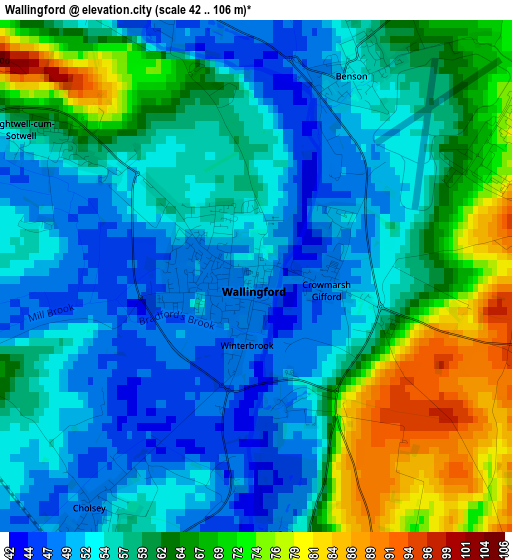
Below is the Elevation map of Wallingford, which displays elevation range with different colors. Scale of the first map is from 42 to 106 m (138 to 348 ft) with average elevation of 58.9 meters (=193 ft) [note 1]
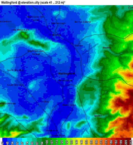
These maps also provides idea of topography and contour of this city, they are displayed at different zoom levels. More info about maps, scale and edge coordinates you can find below images.
| \ | Map #1 | Map #2 | Topo.Map |
| Scale [m] | 42..106 m | 41..212 m | × |
| Scale [ft] | 138..348 ft | 135..696 ft | × |
| Average | 58.9 m = 193 ft | 76.3 m = 250 ft | × |
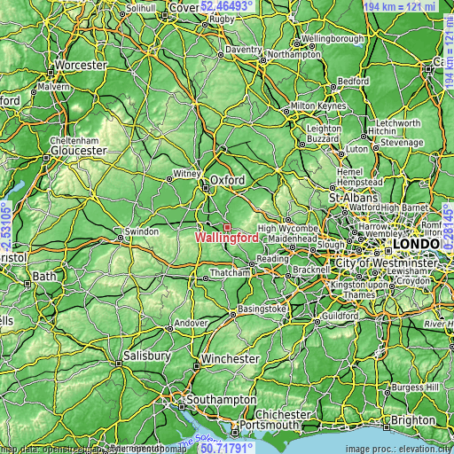
| Width | 6.07 km = 3.8 mi | 12.14 km = 7.5 mi | 194.3 km = 120.7 mi |
| Height | 6.07 km = 3.8 mi | 12.14 km = 7.5 mi | 194.2 km = 120.7 mi |
| ↑Max Latitude | 51.627108° | 51.65438° | 52.46493° |
| Latitude at center | 51.59982° | 51.59982° | 51.59982° |
| ↓Min Latitude | 51.572515° | 51.545194° | 50.71791° |
| ← Min Longitude | -1.168745° | -1.212691° | -2.53105° |
| Longitude center | -1.1248° | -1.1248° | -1.1248° |
| →Max Longitude | -1.080855° | -1.036909° | 0.28145° |
Nearby cities:
Cities around Wallingford sort by population:
• Didcot elevation 58 m
8.2 km,  277°
277°
• Benson 52 m
2.5 km,  24°
24°
• Goring 54 m
8.5 km,  184°
184°
• Cholsey 48 m
3.6 km,  213°
213°
• Chalgrove 68 m
8 km, 24°
• Sutton Courtenay 53 m
11.5 km,  293°
293°
• Watlington 109 m
9.6 km,  59°
59°
• Harwell 80 m
11.5 km,  269°
269°
• Radley 60 m
12.6 km,  320°
320°
• Blewbury 67 m
8.2 km,  245°
245°
• Compton 102 m
13 km,  223°
223°
• Rotherfield Peppard 104 m
12.7 km,  127°
127°
Multilingual:
 En español:
Wallingford elevación 51 m.
 En France:
Wallingford élévation 51 m.
 Auf Deutsch:
Wallingford höhe über dem Meeresspiegel ist 51 m.

Sources and notes:
- [note 1] Map square and city borders are not equal. Map elevation data is calculated only from area inside that square.
- [src 1] Elevation data from geonames database provided with same terms of usage.
- [src 2] The elevation map of Wallingford is generated using elevation data from NASA's 3 arcsec (90m) resolution SRTM data.
- [src 3] Base (background) map © OpenStreetMap contributors tiles are generated by Geofabrik and OpenTopoMap.
Copyright & License:
This Wallingford Elevation Map is licensed under CC BY-SA. You may reuse any part from this page, if you give a proper credit by linking to this URL:
 More info on terms of use page.